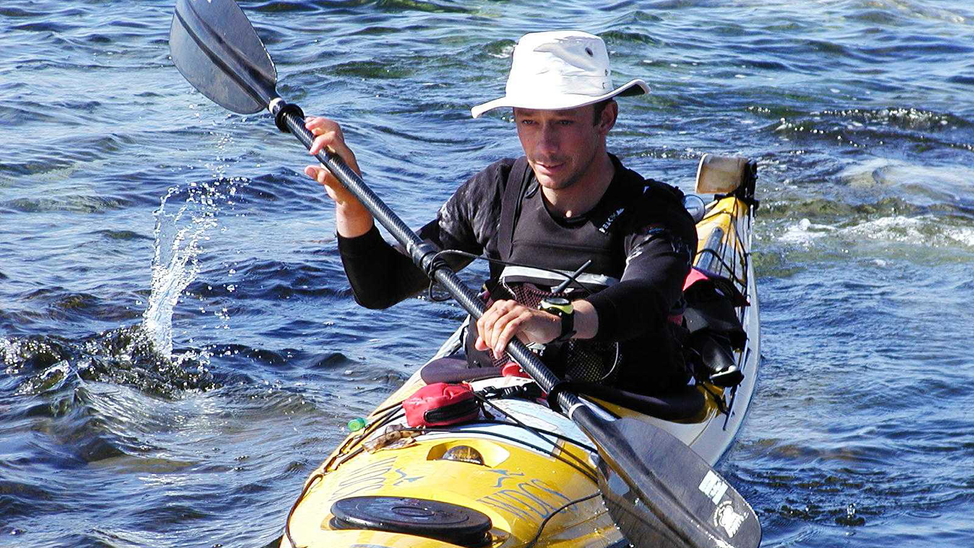
By Richard Atkinson
–
These are the updates written during my solo journey around mainland Britain in 2002, they tell the story of my solo kayak voyage around mainland UK that summer. The journey began on 5th May in Spey Bay, Moray Firth, traveling clockwise and returning to Spey Bay September 2nd. At the end I’ve added some appendices which may be helpful to those preparing a similar trip.
THE BEGINNING – NORTH-EAST SCOTLAND
Report – Monday 13th May – Montrose, Angus
It’s been a good start to the trip, I had a great send off in Spey Bay with a fantastic party the night before and then the launch during the Dolphin Fun Day at the Moray Firth Wildlife Centre, accompanied by WDCS’s life-size inflatable blue whale. I set off in calm seas and sunny weather, great for May in northern Scotland, and running along the Banffshire coast I saw hundreds of gannets, guillemots, puffins and many other seabirds plus a few seals. I stopped over with Dr Kev Robinson of the Cetacean Research and
Rescue Unit in Gardenstown, and headed down the coast to Aberdeen harbour, meeting my first dolphins – 3 of them – as I arrived in the harbour. I sneaked in among the big ships to pay a thank you visit to the coastguard, before paddling on round the coast and camping up in the pretty little harbour of Cove Bay. From the harbour wall I saw a group of 6 or 7 dolphins swimming past the rocks. As I watched one of them jumped clean out of the water. Since then I’ve moved on to Montrose, seeing more seals and what must be thousands of guillemots on my way, and taking in a music festival in
Gourdon as an unexpected contrast to some hard slog days at sea. The good weather seems to have broken for now, so I am perched behind the dunes in a campsite watching the weather for signs of an improvement. Next stop the crossings of the Firths of Tay and Forth.
EASTERN SCOTLAND
Report – Monday 29th May – Saltburn by the sea, North Yorkshire
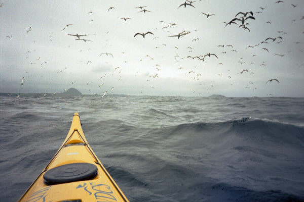
I’m now just over three weeks into the trip, and some 300 odd miles have passed under the kayak. After settled weather for the first week or two however, the wind has forgotten how to blow from any point but south east, which unfortunately is just the way I’m supposed to be heading. Since writing my last update in Montrose, I’ve crossed the Firth of Tay, fifteen miles of open water watching gannets hunting out at sea (these birds drop from a height and hit the water with a whack you can hear from half a mile off). I popped in to the coastguard at Fife Ness for a cup of tea and the following day crossed the Firth of Forth, passing the bird sanctuaries of the Isle of May and Bass Rock.
Bass Rock is a 400 ft sheer sided island which is home to some 50,000 pairs of birds – of which hundreds came out to have a look at the approaching kayak. I was accompanied by a huge, gently circling cloud of these graceful birds most of the way across the Forth. In fact, on Bass Rock there are hidden cameras you can watch the birds with – these relay to the Seabird Centre in North Berwick, which is definitely worth a visit. I was lucky enough to drop in when Erich Hoyt, author and whale researcher, was giving a fascinating talk – very generously he later sent me a parcel of books which greeted me at the end of the voyage.
Since then I’ve been working my way down the Northumberland coast against steady and strong southeasterly winds, visiting Holy Island (where I was welcomed by a resident colony of seals, and escorted away again by a pair of harbour porpoises), passing the Farne Isles and Coquet Island in strong headwinds and being stuck onshore for a few days on the beautiful beach at Cresswell. Friends met me in Newcastle with fish and chips, and in Hartlepool I was given, yachtlike, a berth in the marina and a comfortable bunk to sleep in for a change. The local press even paid a visit and took photographs and details of the voyage, so at least I should be a minor passing celebrity
in Hartlepool if nowhere else. Now I’m in the Victorian seaside town of Saltburn by the Sea, waiting for (yet another) southeast gale to blow through. It’s a pretty period town though, with a pier and even a funicular railway running up the cliffside from the beach to the town. Tomorrow hopefully I shall be on my way to Whitby and so further south – if the weather agrees!
EAST COAST OF ENGLAND
Report – Wednesay June 12TH , Blackwater Estuary, Essex
Hello all! If memory serves my last update was written in the windy northern latitudes of Saltburn by the Sea – I’m down south in Essex now, but it’s no less windswept; I’m pausing here for a couple of days for re-supplies and boat maintenance before heading onwards and into the Channel.
After I last wrote from Saltburn the weather finally eased and I pushed on south, calling at Whitby where a photo and interview was arranged with the Whitby Gazette, and paddling through a calm evening as far as Scarborough. It’s one of the greatest pleasures of the voyage when the wind dies, to paddle on through a still evening and pull ashore just as the light finally fades to cook up a meal. The tranquility and solitude have their own special magic to them, quite unlike anything else. From Scarborough I crossed Filey Bay and passed the gannet colonies of the high Yorkshire cliffs, rounding Flamborough Head in bright sunshine to head in to Bridlington. At the coastguard station I had another interview arranged, with further salty grins for the camera!
South from here the imposing Yorkshire cliffs give way to a low mud cliffline where the shore is eroding at several metres a year. I passed whole buildings tumbling slowly into the North Sea as the waves gobble up their underpinnings – it’s quite a sad spectacle. At the end of the mud cliffs lies Spurn head, a curious spit of land reaching into the sea; on a grey and windy day I picked my way between passing ships to cross the Humber and reach the Donna Nook Firing Range. Here the owl-like calls of the seals greet you – these animals live, apparently unperturbed, right in the firing line. From here leads on mile upon mile of sandy foreshore – featureless to paddle past, and hard to gauge your
position accurately against; dispiriting stuff. As the wind picked up and the sea grew wild again I pulled in at Mablethorpe Sands for shelter. A refuge from the windblown waves it may have been but with nearly half a mile of sandy expanse, it took a Herculean effort to get the boat beyond the high tide line for the night.
In the morning I pushed on to Skegness, pausing for lunch at Chapel Point. A knot of grannies huddled on the beach quizzed me about the usual things – how far out do you paddle, and isn’t it lonely? – and then I was on my way down to Skeggy itself. It is everything you would imagine it to be and, quite possibly, more. The next morning heralded a rare (and highly fortunate) calm day, so I pushed off for the 15 mile crossing and by lunchtime was meeting a couple of other sea paddlers on the Norfolk shore – the first kayaks I’d seen on the trip and nice to pause and talk for a while. Making the most of the calm day I pushed past the long miles of shingle on the tide and finally landed in
gentle surf at Cromer – 40 miles covered in a thirteen hour day!
From Cromer to Southwold however, a similar distance to Skegness to Cromer, took a further three days of bashing into strong south east winds. I passed the seaside resort of Yarmouth on a grey and windy day – a few hardy souls braved the rain on the funfairs but it didn’t look any fun – more like a bad day in purgatory. Making a difficult landing in heavy surf at Yarmouth I pitched tent just beside a golf course. The large signs headed ‘Warning Private’ were sited just too far away to read properly so I bedded down discreetly for the night and moved on quietly in the morning. Southwold is a pretty old seaside town with multicoloured beach huts, and I landed amid these and squelched up to the post office to collect a re-supply parcel – my tent poles had snapped and I’d arranged new ones to be sent on. They weren’t there yet, but full marks to the postman who came out with a special delivery for a canoe somewhere
in the harbour the following morning! Leaving Southwold I could see the nuclear power station at Sizewell from many miles away, but it took ages to reel the huge sinister box in. Incongruously, it sits next door to a pretty village of weatherboard cottages, with crab and lobster boats pulled up on the shore. Beyond Sizewell I paused for the famous fish and chips at Aldeburgh – a lovely place and the chippy does indeed live up to its culinary reputation!
Paddling in to Folkestone I called the harbour radio and arranged to cross the busy shipping channel – Folkestone is one of the busiest ports in Europe and ships line up outside it rather as planes stack up near Heathrow – and nipped between the outgoing Stena catamaran and an arriving container vessel, feeling like part of the same marine world. I crossed to Walton on the Naze and scrunched ashore at the foot of the coastguard station there. The team on watch made me very welcome, so many thanks to Mark, Mick, Dave and Sarah for a hot shower and a room indoors for the night! With just a few hours sleep I was out on the morning tide. Frustratingly, after weeks of bashing into south easters, as I finally turned the bows west the wind veered and I was punching into a force 6 southwester. It kicked up a fierce sea against the two knot tide
and I faced my hardest day’s progress yet, just as I was in sight of a rest and a hot bath – I didn’t know whether to howl or weep with the frustration.
Finally I beached at Bradwell in the Blackwater estuary, dragged the boat into a shed to dry pending repairs, friends put a cold beer in my hand and I slunk into a hot bath – heaven!
THE SOUTH COAST AND WALES
Report – Wednesday July 24TH, Menai Strait
Hello, I’m afraid it’s been a long time since I’ve been near a PC to scribble an update, but at last here it is. I’m currently in the beautiful Menai Strait, waiting for the afternoon tide to take me down past Bangor and so onward towards Liverpool and the final leg of the journey – a return to Scotland!
After I last wrote I waved goodbye to friends at Leigh on Sea and pushed off from the Essex coast, crossing the Thames in a brisk wind and racing tide and working my way around the Kent coast. My first port of call was the resort town of Leysdown on Sea, a place of unrelenting awfulness and not one of my better decisions. A desperate, hourlong boat drag across a quarter mile of oozing mud flats led to a campsite near a loud and tacky amusement arcade… it rained non-stop and to cap it all I awoke to find someone had stolen my tent pegs in the night (give me strength, etc).
Having no desire to prolong acquaintance with Leysdown, I pushed off early, rounded North Foreland, Ramsgate and pulled ashore on the sands near Deal; just around the corner lay Dover, with its congested waters and frantic ferry traffic. The harbour control took it all in their stride however and waved me across between the stern of an outbound ferry and the bow of an inbound dredger, and from there it was just a short hop to the sheer white cliffline of Beachy Head, its red and white striped lighthouse dwarfed by the towering chalk wall above it.
As I reached Hythe the red flags of the firing range were flying, and puffs of smoke accompanied sounds of artillery fire – reluctant to become an unwitting target, I took an enforced pause through the afternoon. Firing finally stopped at 5 pm and I was on my way again – but there was bad news. Lydd Range, ten miles further on, would be firing all the next day. I would have to clear Lydd that night or waste a day sitting on the shore tomorrow. I pushed on to break past Lydd that night, racking up an exhausting 38 miles that day and pulling ashore shattered on a benighted beach. Too tired to pitch tent in the dark, I chanced the weather and rolled out my bag on the shingle to sleep under the stars.
Over the next days I worked my way along the south coast, fighting into strong westerly winds almost every day. Energy reserves drained low, sapped by my long haul into the night to clear the firing ranges, and by days constantly battling wind and waves. Struggling to make 15 miles most days, I watched the schedule slip away from me while feeling powerless to do anything about it, a frustrating and dispiriting experience. However, on the plus side the south coast is home to family and numerous old friends, so for a change I was able to stop off and spend time with familiar faces – my family visited me with a picnic, and I even pulled in at Ricardo plc in Shoreham to catch up with old colleagues. There were some strange looks from people arriving in the morning to see a tent pitched on the company’s front lawn! As I readied to go on the slipway a crowd of inquisitive schoolkids arrived and suddenly we were engulfed in ten
year olds, fascinated at this strange adventurer. Small hands fumbled with cameras and a barrage of questions had to be answered. Ready at last, I rolled up my trousers and slithered the boat across the knee deep mud, children cheering and waving, friends recording the indignity on film.
Gradually I clawed my way windward – through the Solent and across Christchurch bay to Swanage, where once again firing ranges dictated the schedule, this time a 4 am start to get past before hostilities commenced. Visiting Weymouth – delightfully pretty as you enter the town from the sea – I called in to chat to the Coastguard before rounding the notorious Bill of Portland and crossing Chesil beach, a 15-mile stretch of inhospitable shingle and dumping surf. Any landing here can quickly lead to drowning in the vicious undertow, and I’d long worried about this exposed stretch so it was with relief that I pulled ashore after 8 hours without a stop. Slowly I ticked off the shores of Dorset, Devon and finally Cornwall, making steady but hard won progress. In Devon I waited out storms, and encountered some of the wildest seas I’d ever been in. Off Salcombe Estuary at Bolt Head, where tide and river and wind all meet at once to fight over their differences, I found myself suddenly engulfed in wild breaking seas, towering above me and crashing down towards me in walls of white – fighting hard to stay upright and bracing in all directions in the confused seas, I fought for an hour in water that was frighteningly powerful and at times close to terrifying before finally arriving in the tranquil estuary of Bantham, and tying up by the picturesque boathouse with its thatched roof and old ships’ figureheads in the eaves. It was the scene of happy childhood holidays, and a needed tonic after the day’s hard fight on the water.
Land’s End marked a huge psychological turning point – finally I would be heading North, finally each mile would be taking me closer to, instead of further from, Spey Bay and the finish line, and most important of all the strong south-westers would now be blowing on my back – helping me instead of punching me back at each stroke. Heading up the north coast of Cornwall progress seemed to leap ahead – suddenly twenty five, even thirty or more miles in a day were possible. As well, I was now seeing new wildlife – grey seals following the boat along, manx shearwaters zooming up to the kayak at wavetop height, a rare sun fish floating by and even a school of basking sharks. One of these lumbering monsters I didn’t see until he was just feet off the bow. A two foot high dorsal fin slid by inches off my bow and a colossal grey bulk glided primevally past the kayak; close enough to touch, he was fully as long and a great deal more massive than my slender, fragile craft. I admit I felt a minor tremor of fear and instinctively put in a couple of hasty paddle strokes. Basking sharks however, despite their Jaws appearance and massive size, are toothless, gentle beasts, which drift lazily along our coast grazing for plankton, and mean the passing canoeist no harm.
Reaching the northern tip of Devon I made the short hop over to the Isle of Lundy – one of my favourite haunts – and in the Marisco Tavern there I prepared my navigation for the biggest and most committing open crossing of the voyage. I planned to make a thirty mile trip from the Island across to St Govan’s Head in South Wales. Poring quietly over my charts, I tried to be patient with a crowd of onlookers advising me to ‘watch out for the weather’, including one chap who asserted “I bet you’ve never paddled right round Lundy!” The next day saw me miles out on an open sea, paddling on a compass
bearing for a landfall that slowly emerged as a hazy grey outline, gradually took form over the hours to become cliffs and bays, and finally turned into the sandy paradise of Barafundle Bay – an almost tropically beautiful beach on the south Pembrokeshire coast, and a fine reward for a ten hour paddle across the Bristol Channel!
Despite the previous day’s exertions, I had to be on the water at seven if I was to catch the west-going tide, so it was an early turn to. On a bright day I joined the tide race going past the St Govan’s Head cliffs, and by evening I was in the tiny cathedral city of St Davids. The weather now held fair for the first time since the beginning of the voyage in May, and I made fast progress up the welsh coast to Newquay, where a resident community of dolphins was out feeding in the ebb tide as I arrived – fantastic! I’d caught only passing glimpses of dolphins during my voyage, so it was a treat to simply stop and watch them, gracefully arcing out of the water, sometimes noiselesly wheeling back under, other times bursting right out to splash back in with a crash. This is well known dolphin territory and is being studied by the Marine Wildlife Centre in Newquay. Thanks to Steve who runs the centre I had a bed indoors for the night, and enjoyed a beer with the centre volunteers that evening – very civilized!
North of Cardigan I pushed on to Porthmadog, where I had arranged to meet up with Dave Evans of the Cwm Pennant outdoor centre. Dave generously offered to pick me up off the beach with a minibus… however, as we loaded the boat the van began to sink slowly and ominously into the sand! Frantically we tried to dig the bus out as it sunk down to its axles, with us getting progressively dirtier, wetter and more desperate! A passer by stopped, watching our labours for a while before mindlessly observing “You wouldn’t think the sand was soft, would you?” Sensing, perhaps, that he was in greater
danger than even our imperilled minibus he wisely moved on….
Leaving Porthmadog I paddled past the breathtaking but mist-shrouded mountains of Snowdonia, took Bardsey Sound at the slack – a place with a fearsome reputation, but calm on the day I was there, thankfully – and headed north towards Menai. Arriving in the strait just too late to go all the way through (Menai has some of the most complex and seemingly contradictory tides on the UK coast), I pulled up on the slip at the Plas Menai watersports centre. As I pulled in a sailing dinghy passed and we exchanged yells in the wind. “Going round the island?” “Yes, the island of Britain!” “WHAT?”
(hand cupped to ear) “YES”! (for simplicity) He gave me a broad grin and a thumbs-up. “AH! I’VE DONE IT A COUPLE OF TIMES MYSELF!”
NORTH WALES, WESTERN SCOTLAND AND HOME TO MORAY
Report – Post-Expedition (Voyage Ended Sept 5TH)
Hello all,
Firstly my apologies for the long delay since sending out any update! I finally pulled the boat ashore for the last time on September 2nd in Spey Bay, Moray Firth, completing four months and 2,000 miles of paddling! Since then I’ve packed up and moved to Spain and started an MBA, so it’s been just a little busy. My apologies if it’s rather long… I promise there won’t be any more!
So, to pick up where the salty tale left off, in North Wales. By the time Banana Boat – for so my ocean steed is named – (yellow, see?) and I pulled in at the Plas Menai sailing centre she was limping from several impact holes in the bow, major stress cracks parting the central bulkhead from the hull, and a hole torn clean through the stern from dragging the laden kayak over sand. Cape Wrath in such a sad state looked a remote prospect, so we pulled the sorry wreck into the workshop, and worked late into the evening, grinding off the tattered remains of the keel and laying up a shiny new base to the hull. Boat thus patched, we repaired to the bar. The following morning I launched with the reassurance of a watertight hull beneath me once again!
Such are the oddities of the tidal flows around Wales, that the sea is at times several feet higher at one end of the Menai Strait than the other. So the sea surged through this narrow passage like a river, spiriting me effortlessly to Bangor wearing the sort of vacant, inane grin that comes with a free ride. I camped the night on a storm beach at Great Orme, then it was off to Rhyl where the WDCS had arranged a press interview at an aquarium. With a force 6 behind me I surfed in a wild sea the 20 odd miles to beach in front of a camera man for by-now routine snaps, a fascinating tour of the aquarium
and and an education about all the stuff whizzing about unsuspected inches below my backside (best not thought about too much, on the whole). By the time I’d figured out just how much hungry stuff there was underneath me, the tide was miles out, so we perched the boat on the back of the lifeguard’s quad bike and motored down to the sea! After a welcome day’s pause on the Wirral with friends, it was off to Blackpool, a 25 mile crossing forced by the need to clear vast sandbanks that run miles out into this grey and windblown sea, an eight hour stint steadily pulling Blackpool tower out of the haze.
Having by good fortune a string of friends along the coast here, I slept in a real bed for several nights as I pushed north, crossing Morecambe bay and heading up past the Cumbrian coast – quite a luxury! A broken rudder cable forced a day off the water north of Walney Island; by a stroke of good fortune fellow-paddler Michael O’Connell was on the beach that morning. He and his wife took me in, a new cable was ordered overnight from Valley and, grateful for their warm hospitality, I was soon on my way again! Then it was across the Solway to Kircudbright – back in Scottish waters once more! After a good night’s sleep on the beach at St Ninian’s Cave, and a quiet pause at the shrines
hidden within, I set out across Luce Bay, headed for the infamous Mull of Galloway. A strong tide carried me to the Mull in an easy three hours, but as I entered the tide race off the point, I was alarmed to find myself being pushed rapidly south west, out into the open space of the Irish sea. Turning the bow now north, I punched a tide running at some three to four knots, in a bucking and breaking sea. As if in sympathy with the waves, the wind now kicked up and howled out of the north too. Feeling my strength ebbing alarmingly, I knew this was becoming serious – unless I could somehow fight against the wind and tide I would soon become exhausted and be forced to put out a mayday call. I struggled close to exhaustion for a further two hours before the coast
began to inch closer, and finally I beached shattered in a small cove.
Past the Mull of Galloway the coast leads into the Sound of Arran, and I crossed to the Isle of Arran (where, alas, hebridean midges were already salivating at the prospect of my arrival), and headed for the Crinan Canal. This shipping canal leads from Loch Gilphead to Crinan, and with time short I opted for it, piloting my sea-weary craft incongruously between trees and fields. Kayaks being forbidden in the locks, I tied Banana Boat alongside the yacht ‘Anncara’ and sipped a civilised gin and tonic as we motored along! Reaching Crinan all too soon, it was time to don wet clothes again, and despite the oh-so-tempting offers of a stay on Anncara, it was time to go. I knew the tide
to be slack at the Dorus Mor race – If I went now I could be sure of making it through. If later… who knows. If I’d learned one thing on the voyage, it was to go when the sea let you, and the fiercest race on the scottish coast wasn’t the place to test this! So, sneaking past the Dorus Mor while it wasn’t looking (and leaving the still nastier Corryvrecken whirlpool a healthy mile or so off), I paddled into the idyllic Sound of Shuna. Truly, this string of islands is so stunningly beautiful, and a solo kayak such perfect way of weaving among them, it takes on an almost magic quality, a brief foray into another
world.
As I was pondering this, I was hailed from a hundred year old sailing ship anchored in the channel! “Do you want a whisky?” “Have you eaten yet?” Well, these are offers not to be refused! Tying up alongside, I clambered aboard the ketch ‘Leader’, a meal was pressed into one hand and whisky in the other! A delightful hour or so later, it was once more time to desert good hospitality, and catch the tail of the ebb north in the fading light – missing it would mean a day’s delay. I climbed back down into my canoe, waved goodbye, and pushed off into the dusk towards Oban. Passing Kerrera Island in the dark, its gloomy bulk loomed sinister against the black sky, and I picked my way into Oban by the blinking red and green buoys. Ferries, full of blazing lights and deeprumbling engines, thundered through the eerie night and I sprinted between them to find a quiet corner of beach to camp on.
After a day’s frantic shopping for re-supplies in Oban, I pushed on to Tobermory and rounded the most westerly point of Britain at Ardnamurchan Point. Here I stopped the night with three girls doing a whale watch survey from the lighthouse (I’ve always been interested in whales, me). We passed a lovely evening in the old lighthouse keeper’s cottage before, as ever on my journey, it was time to say goodbye and take to the water once more. This was known whale territory and sure enough – soon I heard the distinctive blow of a whale behind me! Spinning around, I had cetacean company as a Minke whale, smallest of the Baleen whales but still the size of a small bus, glided past
some fifty feet away, grey fin rolling gently through the waves. Given that my journey was all in aid of the Whale and Dolphin Conservation Society, this seemed only right and fair but my grey companion, unaware of his benefactor, slid by without pausing to chat.
Picking my way through the sunken valleys that cast Skye adrift from mainland Scotland, I headed on past Redpoint to Gairloch, where Belgian computer Laurence Vanhelsuwe ran down from his croft to meet me at the waterside – later he sent me some of the best pictures I have from the entire trip. Rubha Reidh slipped by, passing a seal snoring as he slept, bottle-like, bobbing in the water and as the sun dipped below the horizon, I pitched camp on a small flat-topped rock out at sea, simply because it looked so appealing. The next day I docked at Ullapool for re-supplies, and it was time to size up Cape Wrath. Exposed to the full force of the Atlantic swells and winds that
blow uninterrupted from Greenland and the arctic, the Admiralty pilot advises that ‘huge seas can build up extremely rapidly’, before making pessimistic notes on passage here in small craft. Cape Wrath had echoed around in my imagination ever since I had first dreamed of the voyage, its wild and powerful reputation unnerving me – this was the final, biggest test of the whole expedition, a genuine challenge in the sense that I would not know until I got there exactly what I would meet. I pushed past Point of Stoer, punching through a powerful tide race pouring south off the point. (I’d nearly come to grief in a similar race in Wales, where waves surging up the tide race had smashed the kayak against the cliff. I had been lucky to escape disaster.)
Fear unresolved, I stuffed the charts back inside the canoe and re-focused my mind on the day at hand. Checking and re-checking my tides and the weather, I set off early for the biggest day of the voyage. Accompanied by my ever-loyal squadron of fulmars skimming the waves and wheeling around me, I set the bow for the last mile north in the UK. The Fulmar is, perhaps, the most magnificent flyer of them all. These birds would circle me most days for hours on end, surfing the updraughts of wind on the face of the waves, wingtips almost brushing the water. Watching them is utterly mesmerizing; in all the long days I never tired of their company. A fast tide under me felt like an
enormous conveyor as I headed for the northwestern tip of Britain, boat rising and falling on a rolling ocean swell. The wind eased just long enough for me to clear the Cape, but rounding the corner the north coast became an intimidating fight in big overfalls and fierce winds. Two thousand miles solo at sea had changed my perspective however; this was a powerful sea, but I had learned how to ride it now – even turn it to my advantage and enjoy the wildness of it. As I pulled the boat ashore that night, I knew I’d taken on, solo, the toughest stretch of coast in Britain – and I’d won! It was a fine feeling as I curled up in my sleeping bag and nodded off, a big grin still on my face.
The northern edge of Scotland seems a succession of empty, windswept, perfect beaches, separated by magical clifflines riven with geos which cut deep into the land – often running back a hundred metres or more before opening upwards via sheer walls to the sky, or tunneling back out to sea by another route. I explored my way along, carefully timing my passage to avoid the infamous tide races of the Pentland Firth. Rounding Duncansby Head, I finally turned the compass south at last! However, now the winds were blowing from the bow again, and progress was blunted as a force 7 halted me in Sinclairs’ Bay. In mixed conditions I picked my way southwards to Helmsdale. Now a day short of my planned arrival, I looked at a borderline weather forecast and pondered – take on the open crossing, or wait? Knowing I was picking a hard fight, but sure of my fitness and strength by now, I headed into the open Moray Firth. At 25 miles, it would take around eight hours. The first two hours were light; but as midday arrived the wind stepped up to F5-6 and soon was I fighting a nasty southwester – as if it was the weather’s last throw. The sea built up quickly and soon the waves were breaking
heavily across the boat. Some 12 miles from any land, losing body heat rapidly in the cold, it was a struggle to hold concentration in genuinely frightening conditions, knowing that the only way out was through, a further five to six hours in mentally exhausting conditions. Waves smashed down on me, at one point tearing the maps from the deck and washing them into the sea. Probably I’ve never been in such demanding conditions for so long; without the fitness and the mental stamina built in the preceding four months I doubt I could have completed the crossing. I yearned to somehow escape, to abdicate responsibility; but I’d got me in, only I could get me out. After the toughest day of the voyage, I pulled into Lossiemouth with relief and was fed hot coffee by a friendly pair of geordies (“From Helmsdale? Good God, we was nervous out there in 36 foot yacht!!”). Unable to unwind from the tension of the day’s
battle, I slept badly but it didn’t matter: tomorrow was the final day, a short hop along the coast to Spey Bay, friends and family and the journey’s end!
On the final morning, I pulled on wet clothing for the last time, turned Banana Boat east and wondered. How would it be to forsake my simple existence of sea and solitude, to exchange it for the company of the madding crowd? My wonderings were punctured as an inflatable zoomed up to me loaded with waving friends, the beach was full of smiling faces I’d missed over the months, cameras clicked and champagne was uncorked; it was the end of a fantastic adventure, a crazy dream I’d followed all the way to see where it might lead. I stepped ashore for the last time, accepted a glass of champagne and felt slightly dazed by it all!
With the voyage completed, it’s time say a big thank you to all the people who helped make it possible – everyone at the WDCS for their enthusiasm and support; Avril for being there 24/7 as shore contact; Arthur and Eileen for their encouragement and invaluable help; my mother for hiding the extent of her misgivings; the coastguard for their professional support and encouragement throughout my journey, and all the friends I’ve met and made along the way, who helped out so generously and who made the journey so much more than a solo passage. And for now, Banana Boat now hangs in the garage, filled only with memories and – who knows – future odysseys yet undreamed?
Richard Atkinson
Appendix A – Equipment
Kayak:
Valley Skerray, ocean cockpit. Modifications: Rudder, double keel strip, foot
pump (mounted on a 50mm box section of aluminium which served as footrest; the rudder bar was then mounted above this), extra hatch covers let into forward part of bow and into front bulkhead to allow access to area behind footrest. In addition the standard glass seat was discarded and a foam ‘Mega’ seat glued in. The tent was stored directly behind the seat and acted as a backrest.
Reasons for choice: The Skerray is not the fastest boat available but is a) a fairly dry boat to paddle and b) stable enough to read a map in a choppy sea. For solo work I prefer to trade the edge in speed for friendly handling.
Problems experienced: Keel strip wore through from dragging the laden boat over sand. I used an inflatable dinghy roller to reduce this but it’s only a partial solution.
Paddles:
Lendal archipelago paddles, carbon blades, glassfibre shaft, variable joint,
secured with a length of thin shock cord. Generally I paddled these with parallel blades; this greatly reduces the repetitive strain on the wrists and reduces risk of carpal tunnel syndrome. Only in F4-5 upward do you notice the wind pushing the paddle back at all. Glass shaft gives some flex, for feel and comfort. Splits were a plastic-bladed version, with non-variable joint.
Camping:
Terra Nova Quasar. MSR Whisperlite stove and cooking tins, 2x 1 litre petrol
bottles. A Zippo will run on unleaded but it kills them eventually. Thin thermarest & chair, vango down sleeping bag.
Problems: Tent poles snapped frequently, apparently traced to a quality problem at the factory. Tent zip fasteners corroded to the zip in the salt environment; all the tent zips failed at some point. Flysheet eventually lost its water-resistance. No problems with any other camping kit, thought the MSR stove did need a dealer overhaul post-expedition.
Safety:
2 Garmin waterproof VHF radios. These were excellent; they come with a spare battery (essential for long periods away from mains power), don’t need a waterproof bag and will fit easily in a BA front pocket. You absolutely need two radios; you cannot change a battery at sea.
McMurdo fastfind 406 EPIRB. Small enough to fit, along with VHF, into BA front pocket. My most prized bit of safety kit!
Upward-facing strobe light on BA. Bivi bag in back pocket of BA.
Reflective strips on boat and paddle.
Parachute, smoke and small white flares. Stored in cockpit.
Problems: One of the VHFs packed up after three months; replaced without quibble.
Two bits of advice I’d give:
1) When it all goes horribly wrong in wild and nasty conditions, you’re going to be left with what you’re wearing and lose everything else. So plan on that basis. I carried the bivi bag, strobe, EPIRB and VHF in my BA.
2) In a way, ALL your kit is safety kit. Epics tend to start off with the failure of some small, apparently peripheral bit of kit, which reduces your ability to deal with the next snag, which causes something else to happen, and so on. Failure of even small ‘trivial’ bits of kit is dangerous. You got hypothermic because you didn’t eat so well because your stove wouldn’t light because the matches got soggy because the container didn’t seal properly on the very day your hatch cover chose to leak, etc. At sea, disaster can be quite a chain of events from root cause, so be sure EVERYTHING is nailed down, be sure you have some redundancy in your key systems and so on. It’s a way of thinking, I think.
Food:
I didn’t take any de-hydrated or ‘special’ foods. I shopped at supermarkets and ate ordinary food, fresh fruit and veg etc, just much more of it, munching through things in their order of perishability. Some tips I found useful were:
– Pitta bread beats other bread as it doesn’t mind if you squeeze it/ crush it into a bulkhead.
– Bacon will keep for at least a week, sausages for 4-5 days.
– Buy things for their strong or re-sealable packaging if you can!
– Eggs are fine if you hard boil all six the day you buy them.
I carried rice, pasta, porridge oats in screw-top plastic jars, and grouped most foods into nylon draw-string bags so I could find stuff/ pack the hatch easily. Breakfast was a big bowl of porridge, lunch was something on a pitta or two (you eat all you can before you chill from standing wet in the wind), dinner was anything but lots of it!
Kayak Clothing
Mountain Equipment fleece salopettes, Helly-type briefs and thin long sleeve top. Yak over-salopettes. Knoydart combination spraydeck (neoprene cover, nylon chest tube – easier for trunk rotation). Stiff-soled kayak shoes (zips, again, a problem). Yak cordura cag – an excellent design which they sadly no longer do. Peak buoyancy aid – vest design allows free chest movement. Tilley hat – keeps the sun off and is stiff enough that it provides a good wave shield when bashing into short oncoming seas. Also floats.
Navigation
Tidal flow atlases for UK waters
All relevant Admiralty charts
O/S 1:50,000 maps marked up with chart info, cut to A4, numbered and laminated double sided (i.e. I laminate maps 1 & 3 back to back, 2 & 4 back to back etc so you have fewer sheets but can always see adjacent maps). This is a long job to prepare but I found it worth it because a) you need a mix of land info and chart info to navigate close inshore and b) it is useful to always know what scale you are working with (charts vary). The 1:50,000 grid is divided into 1 km squares, and 1km is just about half a nautical mile. I divided these into chunks (the whole lot would fill the boat) and had them posted ahead of me as I went.
I did carry a Garmin GPS but found I rarely used it.
Note that you can source charts secondhand (contact Marine Chart Services in Wellingborough). This is far cheaper and since most of the kayak-relevant info doesn’t change much, it’s a reasonable economy to take. Cliffs and overfalls don’t move about very much; it’s generally buoyage changes and the like that put charts out of date.
Sundries:
Sunglasses – get a good pair with wrap-around lenses. You need these for the sun, but also to keep the constant spray off your eyes or they eventually get full of salt and sting a lot!
Headtorch – get one that uses LEDs rather than normal bulbs. The batteries will then last for ever – I never changed a set in the four months.
Camera – I used a waterproof Canon Sure Shot 35mm. Digital may be fine if you can keep the batteries charged. The Canon was totally reliable and waterproof and it floats.
Mozzie net – an absolute must once you’re in Scotland.
Phone – Nokia at least do a semi-waterproof one. Take a spare battery or find a way of charging it away from the mains (Freeplay now offer a gizmo that does this).
Water – I carried 2 X 2 liter and 1 X 4 litre Ortlieb bags stored infront of my feet, plus one 2 litre platypus carried on the rear deck. If you do this take one or two spare bite valves, as they fall off.
Repair kit: Plumber’s Sylglas tape, spinnaker repair tape, tube of gelcoat, various replacement fasteners. Leatherman type knife tool. In my view there’s not much point carrying a proper fiberglass repair kit; you’re unlikely to be able to get things dry enough for long enough to really use it. With hindsight I would also take a spare rudder cable.
Non-kayak clothing: Take the bare minimum; I reckoned this to be one pair light trousers, 2 shirts, one fleece, a warm outer coat, a few set of undies, one pair boots.
Ensure that whatever you take can dry quickly (so no jeans) as otherwise when it gets wet it will stay so which is deeply miserable. Boots are bulky – go for something you can crush down easily, with a good sole and preferably semi-waterproof. I used old DMs.
Appendix B – Some Notes on Routine
Water:
You probably need 2-3 litres per day for drinking and cooking, and since water
is heavy you can’t carry much of it (for me 8-9 litres was the maximum). So every third day or so you need to get fresh water. This makes the trip begin to feel like a tour of the UK’s coastal public loos.
Battery charging:
Keeping VHF and phone batteries charged is a constant concern. My
Garmin VHFs had two batteries each, if I had all four charged I was generally OK for 1-2 weeks.
Petrol:
Surprisingly perhaps, this is one area that’s not really a problem. A litre of fuel
lasted me 3-4 weeks, and doesn’t take up much space.
Bad weather days:
Over the length of the trip, I averaged one day in four off the water
for bad weather. I think this is similar to other people’s experience around the UK.
Communications:
I briefed the coastguard ahead of my journey, and then contacted
them at the start and end of every day on the water. They deal with plenty of ejits so take the trouble to go well prepared. They could not have been more helpful to me throughout the voyage.
Appendix C – Training and Preparation
Sea skills:
I took the theory part of the Yachtmaster exam, which covers navigation,
meteorology, rules of the road etc. Essential preparation, anyone contemplating a major sea expedition should do this.
Fitness:
I trained several times a week in a K1, plus several long crossings at sea as I
built up. You probably need a good three months to get fit, depending on where you’re starting from. Within bounds, you can allow your fitness to build during the trip if you’re cautious in the early days.
Experience:
Do as many multi-day trips with all your intended kit as you can so you
learn what does and doesn’t work for you while you still have time to change it.
People:
Talk to wizened old voyagers who’ve done it before, they’re happy to help if
they see you’re preparing properly.
Books:
Read Bill Taylor, Brian Wilson, Chris Duff etc. Also solo yachtsmen and polar
explorers useful, many of the mental/ emotional challenges are, I think, similar.
Appendix D – Costs (approximate)
EPIRB – £400
Radios – 2X £200
O/S maps of UK – £400
Charts – £7-800
Kayaking and camping kit – budget on buying new for most items even if you already have kit. Anything that is either part-worn or not of the highest quality is going to fail you at some point in the trip and this is usually where epics begin.
I think I probably spent around £6,000 in total on the voyage.
Appendix E – Medical Notes
Wrists
I paddled with parallel blades to avoid carpal tunnel syndrome (caused by constant wrist rotation), but still found that by about half way my right wrist was beginning to seize up. Even with parallel blades I was tending to use my right wrist as the control wrist and thus use a firmer grip. I practiced switching the ‘control wrist’ to the left hand and eventually re-trained myself to use a fairly even grip between the two hands.
Eyes
In the early days I paddled without sunglasses on overcast days. The constant spray in the eyes builds up the salt and eventually this became quite uncomfortable so I began to use the glasses all the time, as much as water shield as sun shield, and the problem eased.
Rashes
Wherever the clothing rubs, you’re going to get sore. Just make sure the clothing is as comfortable as possible before you go. Do some long crossings in it to find out! Cream will soothe things but really you’ve just got to try different kit until you find something that doesn’t rub.
Skin splodge marks
My hands became all splodged like your granny; apparently it’s the sun, they do goaway. Except if they’re cancerous.