The UK has a number of rivers that form tidal bores. From a kayaking point of view many of these are surfable – to a varying extent. While some provide a dynamic, boisterous challenge, others are little more than a tick-in-the-box for the ‘bore-spotter’.
For a bore to form we need a wide, flat estuary that quickly narrows into a relatively shallow river. After the incoming flood tide crosses the wide estuary and reaches the narrow river channel it is ‘confined’ and surges, causing the formation of a vertical wave. This is the wave we use to surf.
In the UK bore waves vary from a few inches high to a number of feet. Their form can vary between a green wave to full-width broken soup. Timings are usually predictable for incoming bores, though they may vary due to weather and river-levels. Wave conditions can vary greatly however, with river-levels being the most significant factor. Atmospheric pressure and wind direction/strength also have an effect.
The best wave conditions tend to come from low river-levels and little wind. High river-levels can wipe out a bore almost completely. Low river-levels can cause problems too, ahead of the wave you may yourself ‘bottoming-out’.
River Dee Description
The River Dee ticks a number of boxes nicely. It provides a fairly clean surfable wave that runs for around 3 miles, giving a ride of 30 minutes or more! It is relatively easy to access, is predictable, fairly consistent and not too crowded.
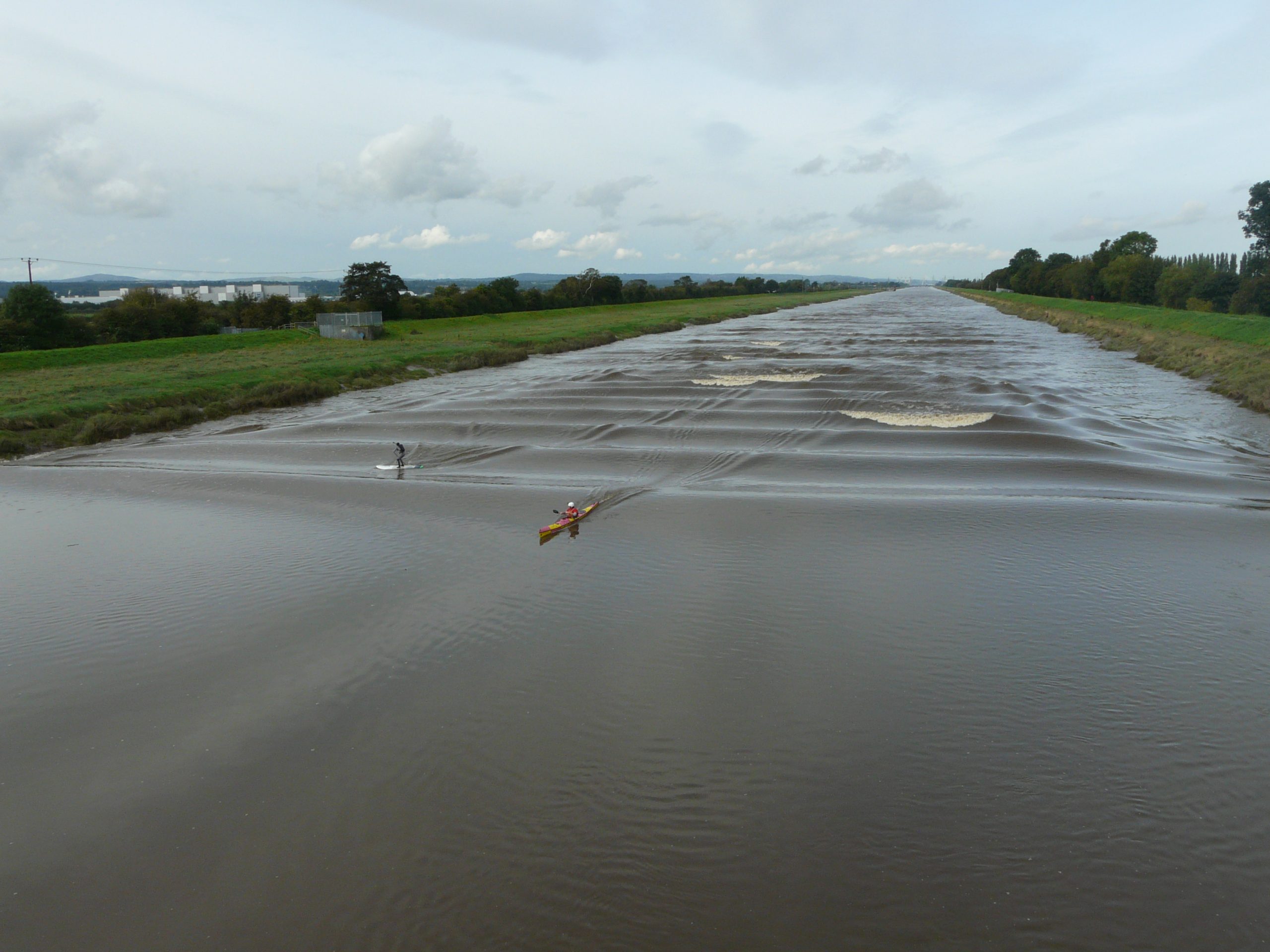
While the Dee Estuary is over 3 miles wide for the most-part, it quickly narrows downriver of Connah’s Quay. Here the river enters a narrow canalised section, which runs to the outskirts of Chester, where it returns to the meanders of the original river.
The canalised section begins downriver of Queensferry and runs dead-straight for 3 miles or so, to Saltney Footbridge. This gives it a fairly consistent and predictable wave, which forms across the full-width of the river channel for much of the length. In the right conditions the wave is surfable all the way to Saltney, and forms a surfable wave even as far as The Cop on a good day.
Downriver of the Jubilee Bridge (Blue-Bridge) at Queensferry, the channel is a little over 100m wide, while at the upper reaches it has narrowed to around half of this.
Terminology:
‘Downriver’ and ‘Upriver’ relate to the usual flow of the freshwater river (not the incoming flood) i.e. a location downriver of Chester would be closer to the sea.
‘Left’/’Right’ bank relate to the direction of paddling at the time – look to your left – that’s the Left bank.
All tides relative to Liverpool (Gladstone).
Wave heights:
- 1 ft – reaches the bottom of my B.A
- 2 ft – shoulder height
- 3 ft – top head height
- 4ft – looking up at it.
Get On
There are 3 options really:
- Saltney Footbridge – (SJ 370, 655)
Easy parking in a small car park on Ferry Lane, N bank.
Fairly easy get on (N) bank- maybe a little muddy. Sometimes danglers are to be found here.
Downside: you have a 3.5 mile paddle to meet the wave – making timing a little trickier.
Upside: you will have a fairly short paddle and easy-ish get out at the end. You may have to wait for the water level to rise a little.
Alternatively there is a small rough-ground car park on the S bank NE of Saltney, on the corner of the B5129 by the bridge. This gives access to the muddy riverbank.
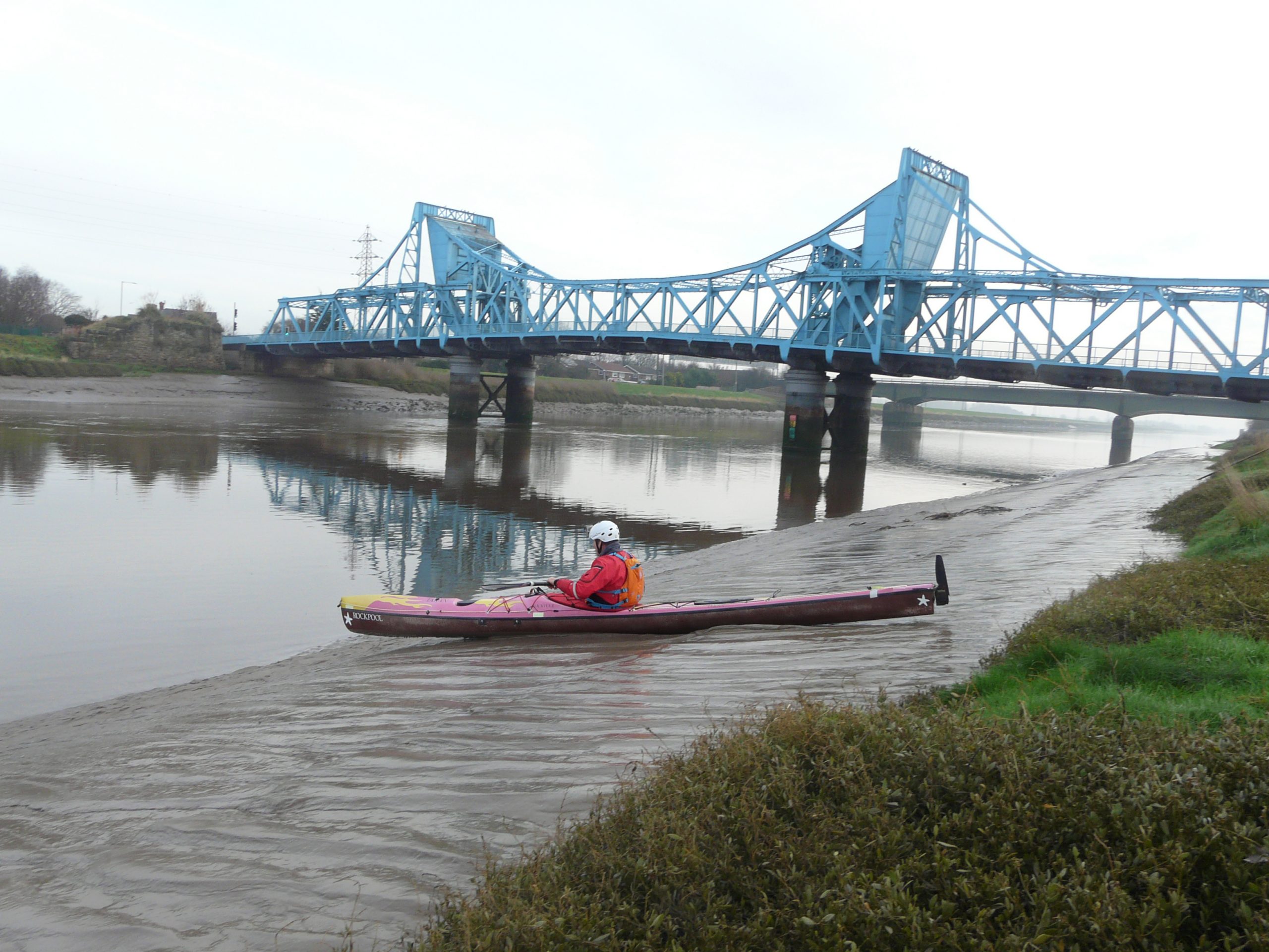
- Jubilee Bridge (‘Blue-Bridge’ – ‘Old Bridge’) at Queensferry – (SJ 321, 686)
Limited parking.
Access to the river bank is easy (S bank) but access to the water is tricky – there is plenty of mud here. (Don’t get stuck with the Bore coming in!)
Downside: long paddle back or shuttle from Saltney (or alternative get-out).
Upside: you are only a few hundred metres from catching the wave – timing is easier.
- Connah’s Quay Slipway – (SJ 295,698)
Easy parking.
There is a slipway to access the water but it can have a copious coating of mud.
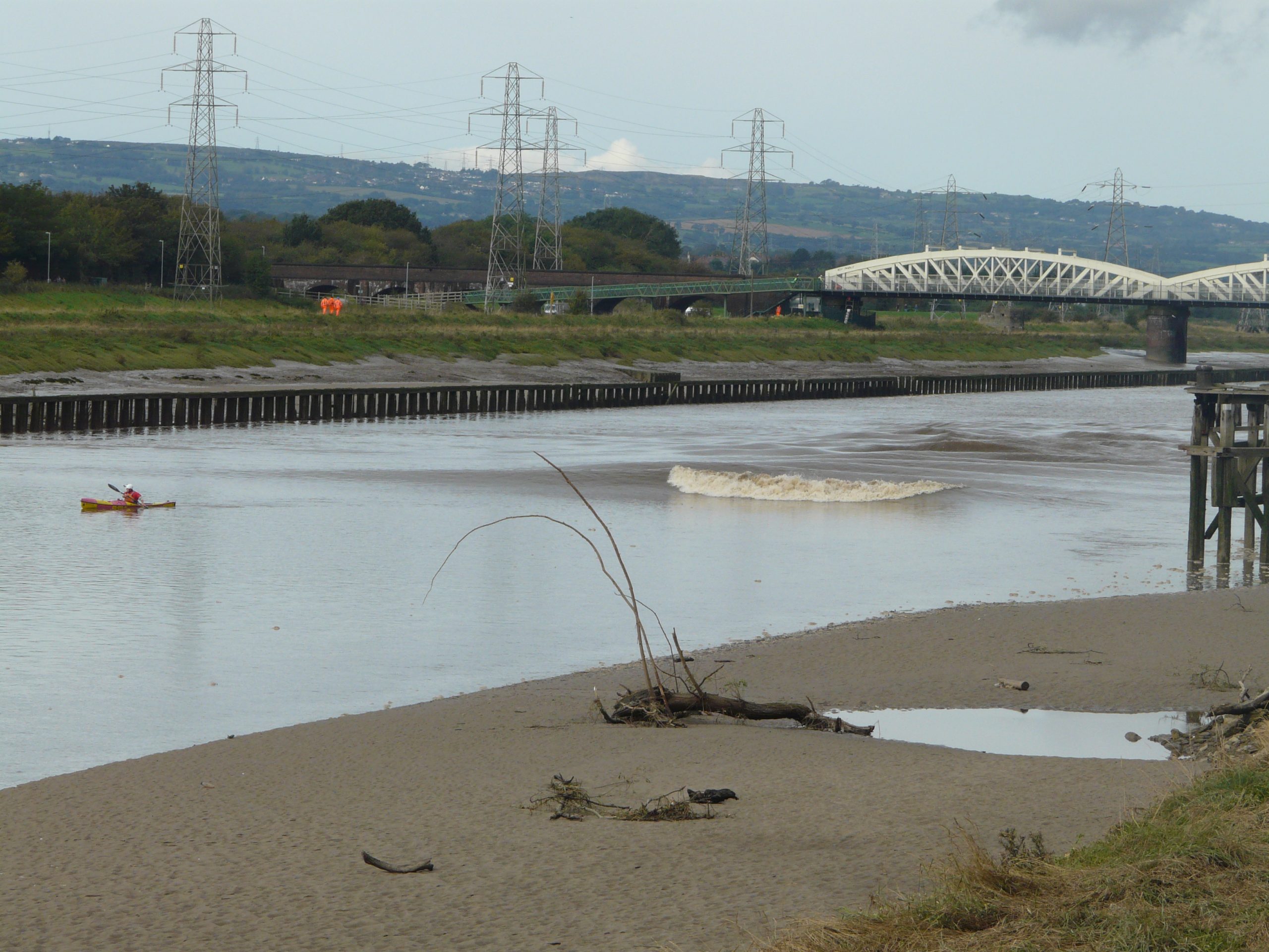
Downside: Even longer way to paddle back – a shuttle or alternative get-out is required again. Don’t get fooled by the wave forming before the Railway Bridge – there’s a good chance it will fade just before the Jubilee Bridge , and again at the A494 Bridge. (See later.)
Upside: close to the ‘start’ and gives the longest ride.
There are alternative get-outs at:
The Cop (SJ 396,666) – For those who stay with the bore until the bitter end. Limited parking. You either have some undergrowth to contend with here or have to wait for the water levels to rise for a time. I’ve used this get-out a number of times.
There is access to the river bank S of the ‘Old Dee Bridge’, close to the Chester Rockdragon. Parking is limited to residential street parking in the area.
Get Out
Your options are basically your get-on locations – Saltney Footbridge, Queensferry or Connah’s Quay – wait for the tide to ebb before slogging back.
There is a sneaky get-out option at the 90-degree bend at The Cop (SJ 396,666) – for those who stay with the bore until the bitter end. However you may have to wait for the water levels to rise to egress, and it may be overgrown in the summer. Car parking is limited to a small section of rough ground.
Alternatively, with the luxury of a shuttle or a driver, you may want to continue into Chester.
There is access to the river bank S of the ‘Old Dee Bridge’, close to the Chester Rockdragon. Parking is limited to residential street parking in the area. There is also an option to get-out in the car park at Sandy Lane – but ONLY if the weir is safe to paddle over.
Personally I get out at one of the 3 get-ins, Saltney is probably the most-straightforward.
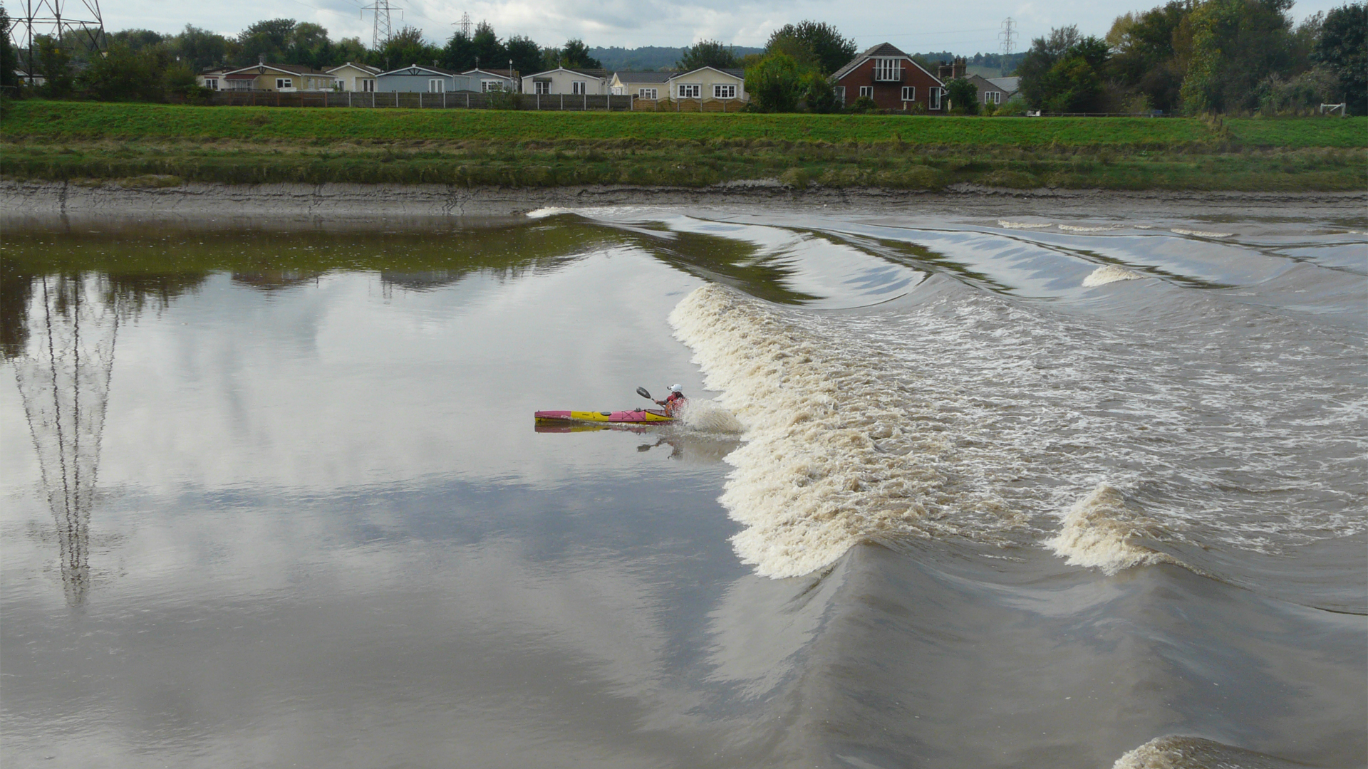
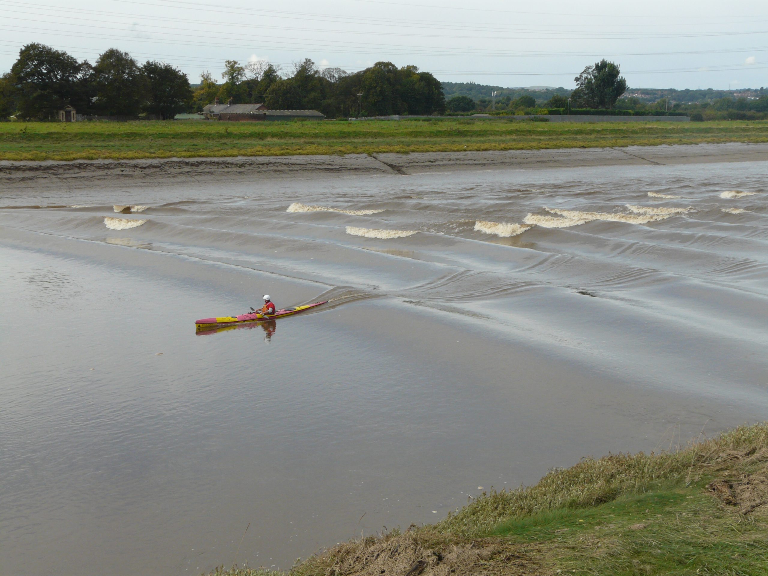
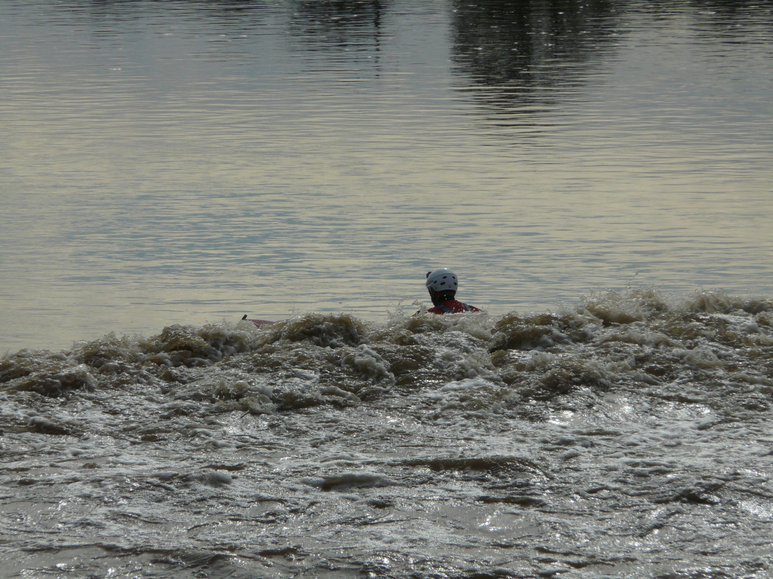
Catching the Wave
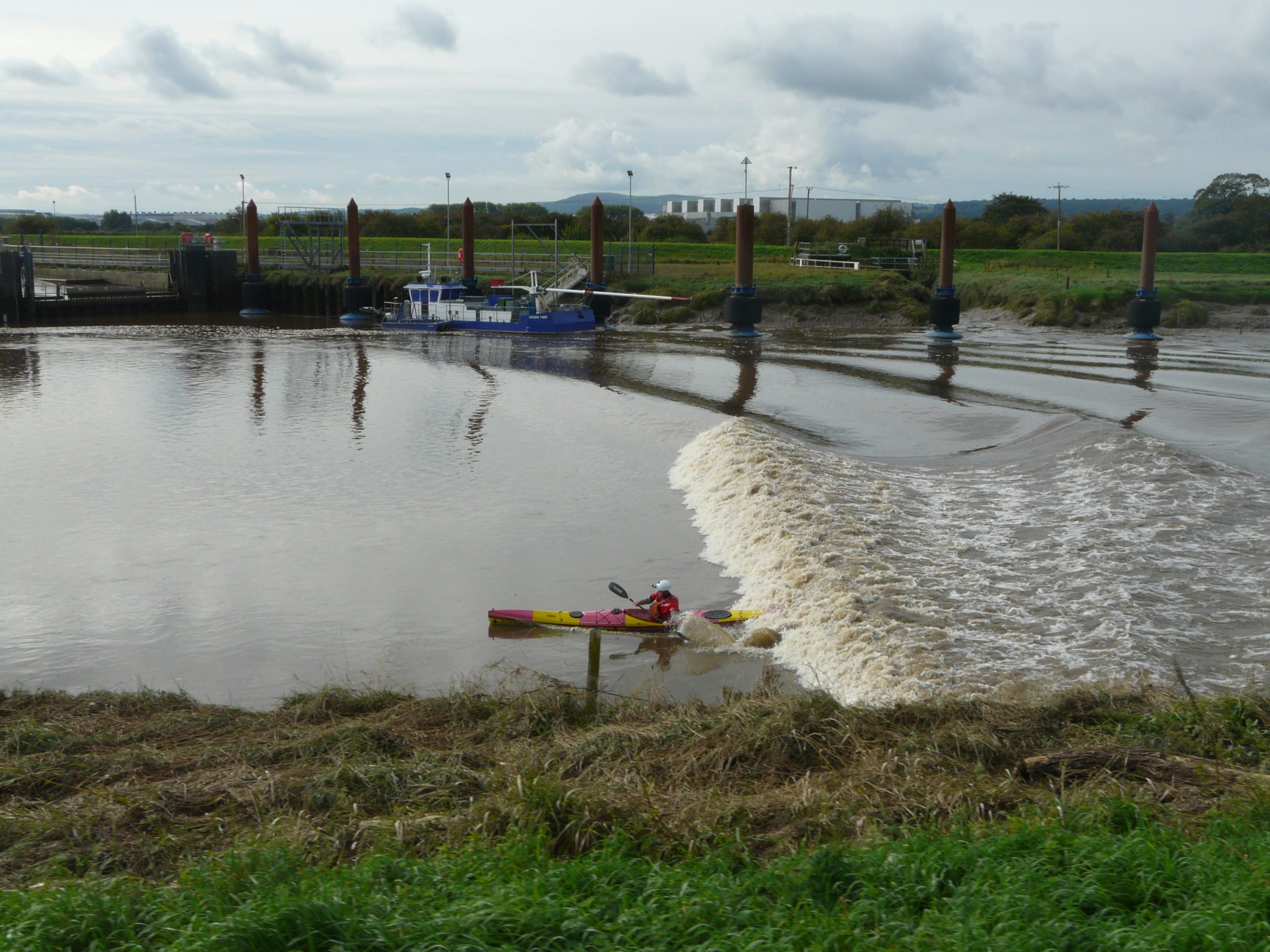
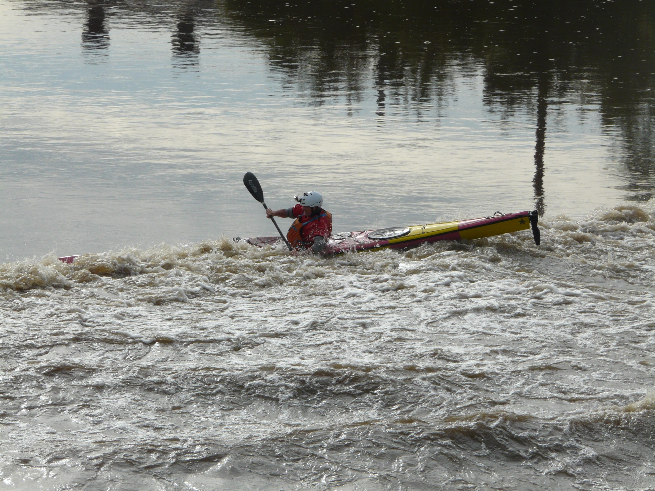
A broken full-width wave has formed as it rounds the corner on the way out of Connah’s Quay. But as the river deepens near the Railway Bridge it may fade, to reform short of the Jubilee Bridge. Soon there is a sneaky-fade, just before it reaches the A494 dual-carriageway bridge, where it finally reforms, to then stay the distance.
I think it is best to catch the wave about half-way between the Jubilee Bridge and the Railway Bridge – however be aware of that false-reform and sneaky-fade before the A494 dual-carriageway bridge. A sprint is required here – I prefer the eddy tight on the Left (N) bank. The Right (S) will do too, the fade is shorter on this side, but it can be shallow and a little rocky.
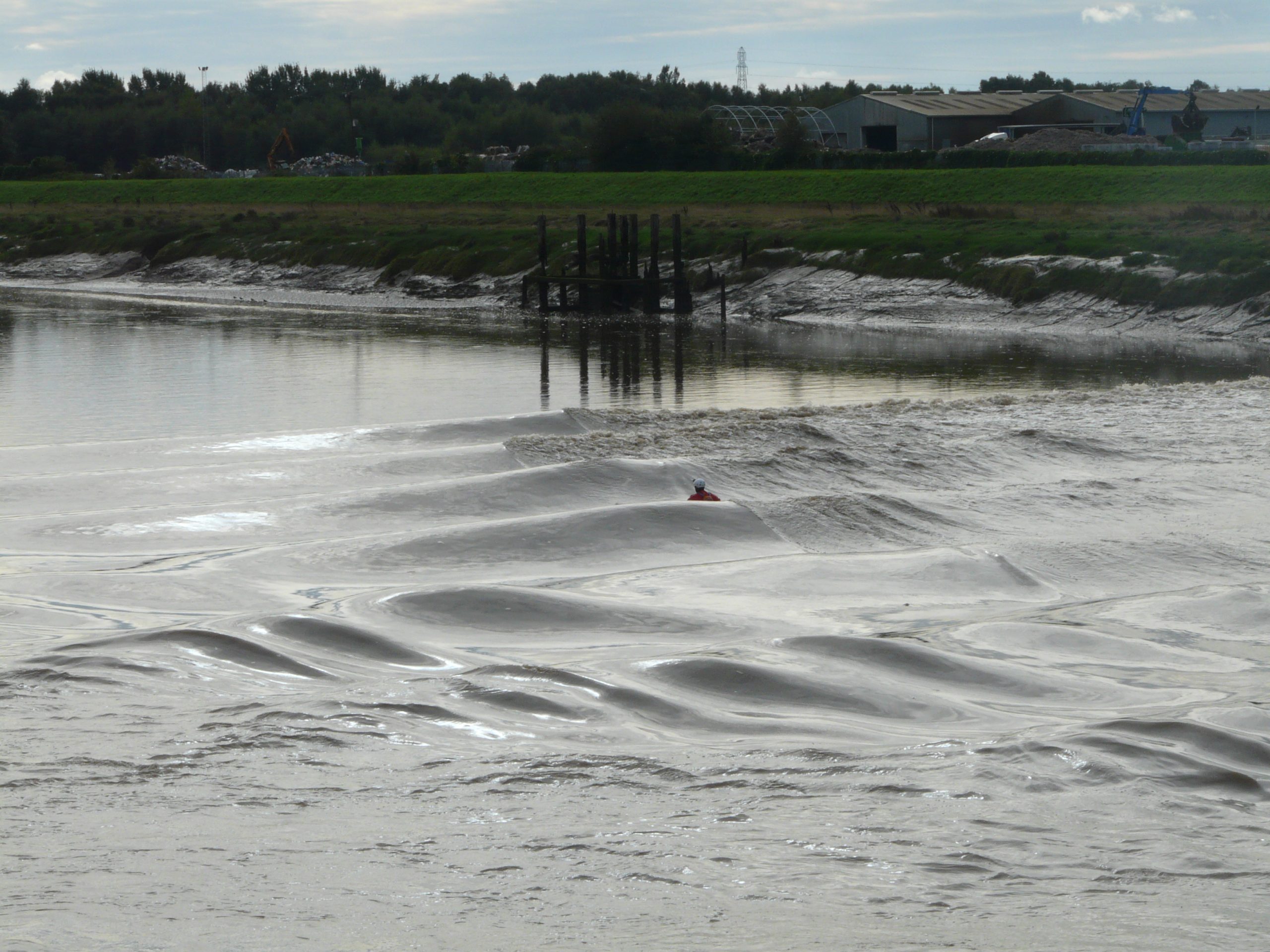
Running the Wave
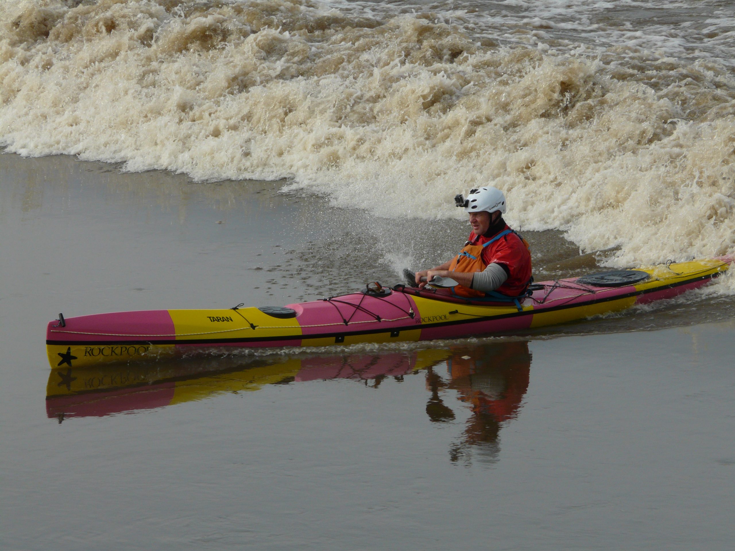
If the conditions are good then the wave will run all the way to Saltney Footbridge, and beyond. It will fade and form as it goes, anything between full-width green, part-broken and full-width broken. In the early stages after Queensferry you may get 3ft+. As you move further upriver then the wave height will generally decrease to 2-3ft by Saltney.
Keep your wits about you and be prepared to move across river to catch the best wave. Daydream and you will get caught out.
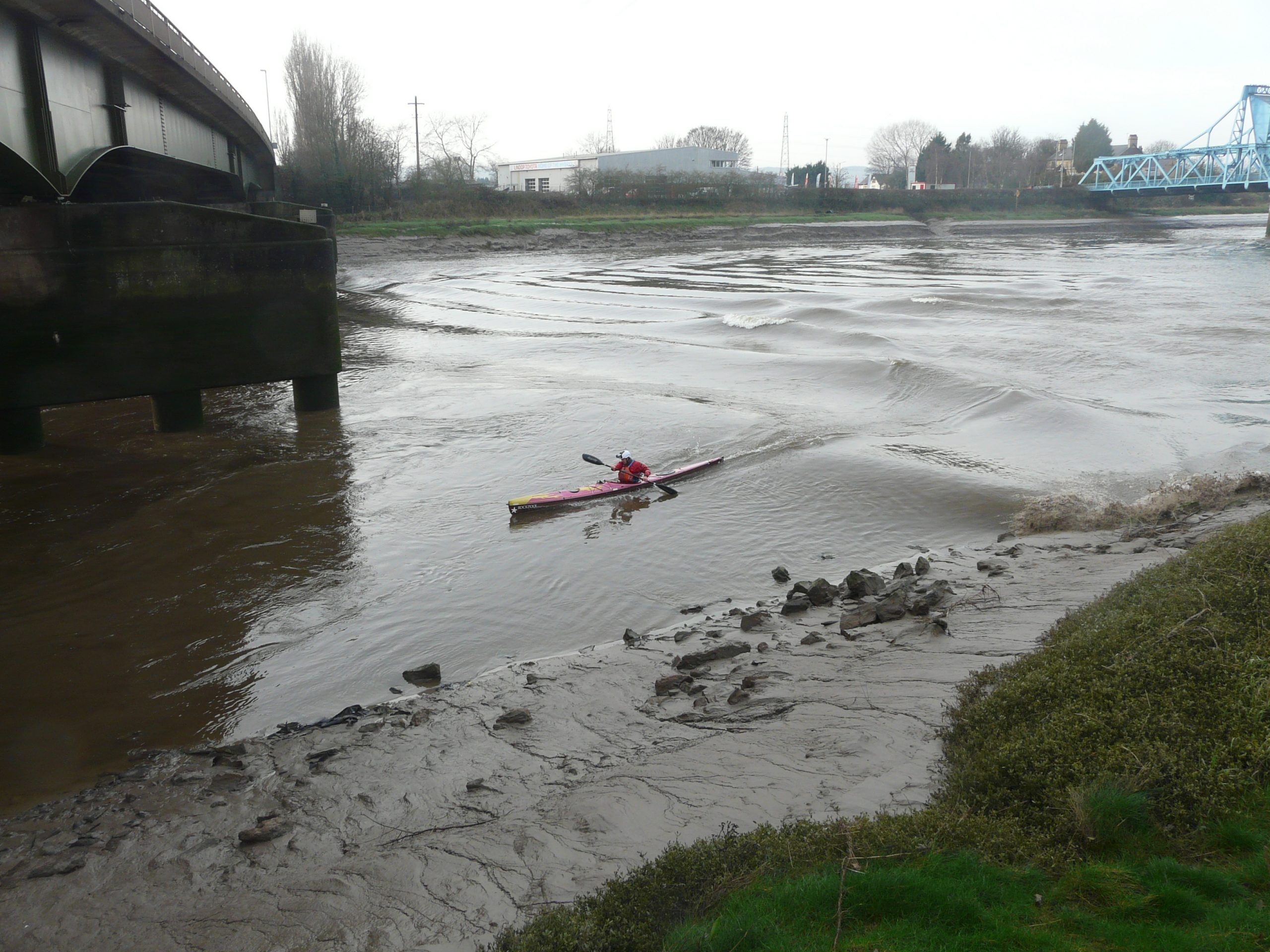
Close-before the Saltney Footbridge it shallows on the Left, so set up before on the Right.
After Saltney Footbridge things get a little trickier. There are two 45-degree bends; the waves feed unhelpfully on both corners. The Left (N) bank is shallow and feeds. On the Right (S) bank it is deeper but faster and flatter. Right to Right-of-centre gives the better option, but nothing is easy here. Beyond the bends, on the final straight, the wave pattern can become confused and fade and re-form a number of times. Take what you can get – Right bank is probably better.
Later, just before the 90-degree bend at The Cop, the wave may reform for its final hurrah., a 2-3ft steep green wave. You’ve done well if you’ve made it this far.
Now the flow will take you to Chester if you desire, however the wave is effectively done. It’s a pleasant paddle, but adds distance to the return journey, if you are paddling back to a get-out. Beware of the weir and fish-ladder in Chester – both can be dangerous at certain river levels/parts of the tide.
Hazards
Soft mud – like many tidal estuaries/rivers there can be copious amounts of soft mud and silt. Beware! Get caught in this as the water levels are about to rise and your future is limited.
Be aware of riding a full-width broken wave – unlike ‘the soup’ on a beach this wave can stay broken for a prolonged time without diminishing. Bongo here on a larger day and you may just find out how long you can ‘side-surf’ for before it ends dramatically.
A derelict wooden wharf/pier on the Left bank between Railway Bridge and the Jubilee Bridge.
A couple of derelict wooden wharves/piers on the Right bank upriver of the A494 dual-carriageway bridge.
The Airbus loading ramp – about 2/3rd way along, on the Right (S) bank – marked by a series of large metal stanchions a few metres from the bank. Craft maybe moored/beached here.
Large pieces of detritus and rubbish will be lifted from the river banks, and even the river bed – beware throughout.
Long stretches of both banks are littered with sharp rocks along the water’s edge. Hit these at Bore Speed (especially if you are swimming or upside down) and there is a good chance of significant injuries! BEWARE!
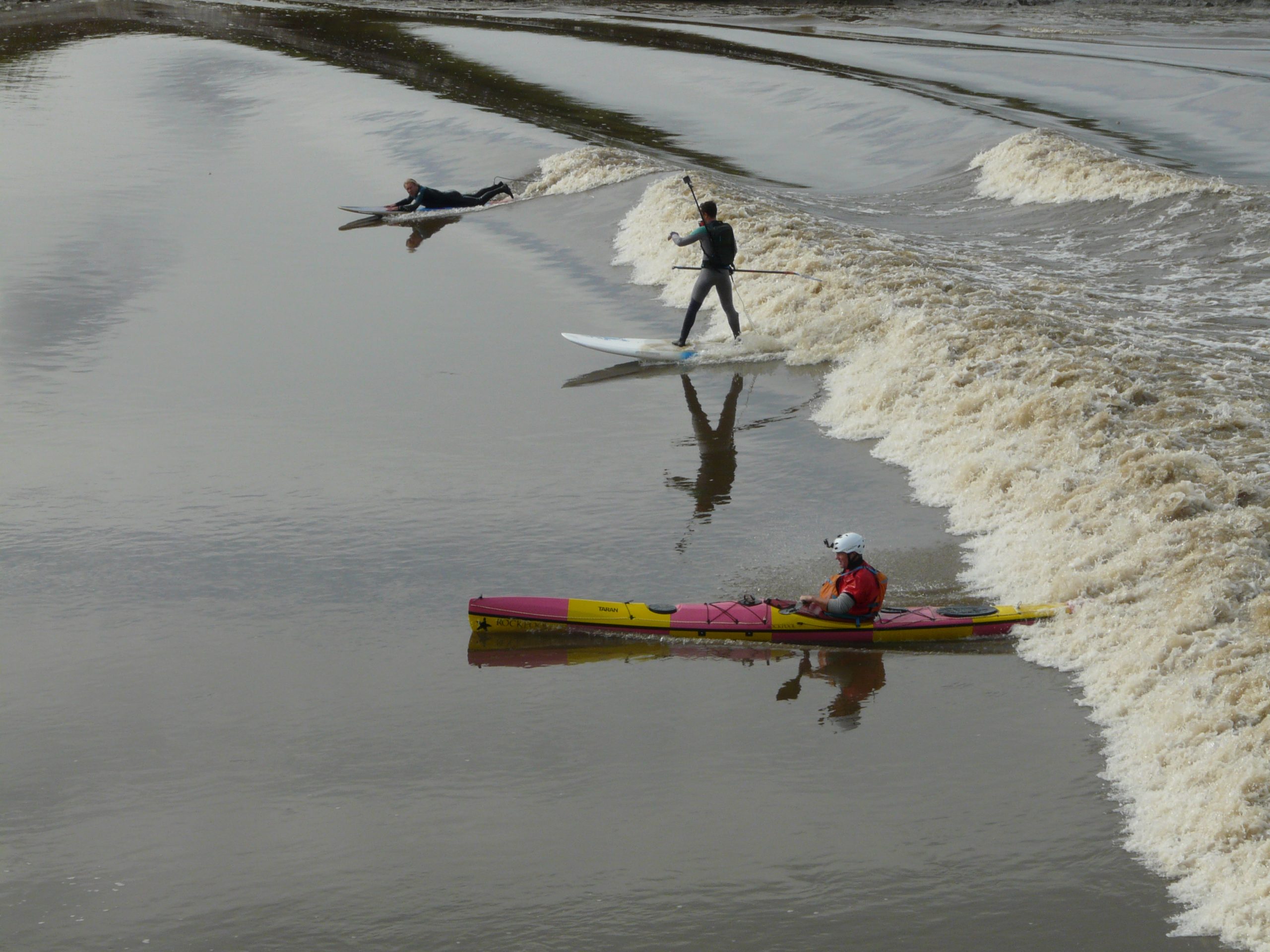
Be aware of other wave riders – sea-kayak bongo-sliders are rarely welcome.
Danglers possible by the Saltney Footbridge – usually East bank.
Tides and Timings
The Dee Bore wave tends to reach the Railway Bridge/Blue Bridge about High Water Liverpool -1:50 / -1:40 – but timings are approx.
The best waves come from 9.5m tides up, but may be useable below that. Expect more white-water on 10.0m tides and up.
Lower river levels on the whole seem to give more broken and steeper waves, but atmospheric pressure, wind direction and speed also have a significant effect. The river levels can be found online via the monitoring station at Farndon.
River Levels
River levels can have a significant effect on the bore wave – if the levels are high then the wave will tend to wash-out, if they are low then the wave will be full-width-white for much of the way and tend to feed towards the banks.
If you are paddling a ruddered long-boat such as the Taran then the lower levels can be a bit of a handful for a long ride. Bottom-drag becomes significant and makes it difficult to keep ahead of the wave and so the stern becomes light, combine that with the feeding characteristics and you find you need to work to keep it all together – don’t be surprised by a few more bongos than usual!
On the up-side if you are in a short boat then the lower levels make for a prolonged ride on in the slow soup, you don’t have to worry so much about being out run by the wave.
I use the gauge at Farndon to measure the levels and find <5m as low for the longer runs.
Tips:
Don’t be late – once it’s gone it’s gone!
Use a fast boat – you’ve got a better chance of getting back on or catching a second wave. A short boat works better in the soup and on the steeper waves, but you may suffer from lack of speed when you most need it.
You are likely to get muddy or even may need to seal-launch to get in. Bring something to clean your footwear perhaps?
Keep the boat straight if you want a long ride – if you want to ride the front wave it’s likely a one shot affair – have a broach and the day’s probably done.
If you do find yourself in a ‘bongo’, be patient and wait until things are ready, then quickly push the bow back upriver. Stay away from the shoulder, or the bow is likely to ‘peel’ downriver, then the bore will continue without you.
However if you do drop off the front wave, all is not necessarily lost – but you will have to react quickly. Don’t let the boat turn downriver. There are secondary waves that surf fine, grab one quickly.
If you want to try to get back on the front-wave, then head quickly to the nearest bank and use the slacker water to work your way back up. It is possible but may involve long, hard-work to get there. At times it can get a little claustrophobic close to the ‘fast-moving’ bank. Get it wrong and a nasty ride over the rocks may ensue – be careful!
Whenever the wave starts to fade you need to paddle hard – as the water depth increases the wave height will decrease and speed up – you need to pull hard now, if not, you will watch it reform ahead of you.
And finally, for a feel for what it is like, here is the view from the driving seat:
More views of the Dee Bore on the PSK YouTube Channel:
https://www.youtube.com/playlist?list=PLqzC-41FmRz0YBAXQ8KbB9b_EQkFd-WXo
Other UK Bores to consider:
-
- River Kent (‘Arnside Bore’ – Morecambe Bay) – forms downriver of Arnside
- River Lune (Morecambe Bay) – forms at Sunderland Point
- River Winster (Morecambe Bay) – Grange-Over-Sands – possibly the world’s shortest bore.
- River Eden (Solway Firth) – forms downriver of Carlisle
- River Esk (Solway Firth) – forms near Gretna?
- River Nith (Solway Firth) – forms downriver of Dumfries
- River Great Ouse – Kings Lynn?
- River Mersey – forms downriver of Widnes?
- River Parrett – Dorset?
- River Ribble – forms upriver of River Douglas confluence
- River Severn
- River Trent (Lincolnshire) – forms upriver of Scunthorpe
Go on, blag a bore!
by John Willacy