In July 2022 I paddled a single-day, 116 km lap of the isle of Islay, Scotland. Here’s the story:
The Challenge
I like doing these things, paddling laps of islands. It’s partly the test of making it around under your own steam, the physical and mental challenge, but I also like solving the tidal-puzzle, getting it all right to make it around in one go. It’s rewarding.
Usually I go against the clock when I paddle a lap. It keeps me honest. It stops me wimping out when things get a little tough. It also ensures I do my homework beforehand: understanding tides, weather and conditions, updating skills and technique, developing fitness and planning a strategy.
Basically it all makes me get off my fat-ass and lift my paddling to a higher level. Not a bad thing.
And Islay? Well Norbert Ziober is the only paddler I know who had paddled it as a single-day-solo. He told me all about his trip and suggested I give it a go. Sounded like a good challenge.
Outline plan – A look at maps and stuff
Things start off with a simple outline plan. This is little more than a look at map, chart and pilot book, to get a rough idea of the undertaking and answer a couple of questions:
How-long?
And what-dodgy-bits?
The first question gives a rough idea on how long I am likely to be in the boat, and so what physical training I need to put in place. It also gives an idea of how long until I need to do it. One divided by the other gives a rough idea of how far I need to progress each month in training. (There’s a little bit more to it, but we’ll cover that another time)
The second question highlights any specific skills or techniques that need to be worked. Maybe tide race practice, scratching, after-dark nav etc. In the case of Islay, a few tide races are expected, so a bit of tide race ‘paddling through’ work is added to the programme.
These questions also start my mind-wandering on the subject of the on-the-day strategy: crux-points, start points, start times etc. It’s slow burn for now, but it gets me thinking.
Tidal Planning – When and where
Paddling hard can make minutes of difference, however planning can make hours – either up or down.
So a lot of time goes into the Tidal/Paddling Plan.
Hours are spent understanding the Tidal Stream Atlas, while good info is gleaned from the Yachtsman’s Pilot too. Charts and the good old OS Landranger map help familiarise with the locale. Even Google Earth is roped in, helping to assess likely launching and landing spots.
Not all answers are in the data sources of course, but eventually you start to get a feel for the place and what to expect. A good plan can make a place surprisingly familiar, even though you may never have been there before.
The Recce – Know it all
However nothing does replace being there, and that’s where the Recce comes in. It provides practical and useful knowledge of the locale, and also gives a comforting feeling of familiarity and knowledge.
A paddling recce along parts of the coastline can be useful, but the more mundane aspects are significant too: car parking, food shopping options, accommodation, drive times, even toilet locations etc. A recce may entail a specific visit, a previous paddling attempt or just an excuse for a holiday! For Islay our recce came from a visit to Jura a number of years prior.
Paddling – The Training
However it’s not just books and cups of tea. The physical side has to start too.
By New Year it is time to put the serious-head on for the physical training aspect of things. Plenty of paddling with a backdrop of land training for non-paddling fitness, and ergo work for strength/stroke. The boat training is varied: long miles, bad-weather paddling, long-interval sessions, a few time-trials and technique and boat skills, along with the usual sea-kayak drills ‘n’ skills. All with plenty of moving water work of course. ‘Cos I like that bit the most.
I like to use progress goals along the way – smaller attempts and paddles that stretch the training. These bring motivation, and confidence, but also larger scale training value. They act as dress-rehearsals too, a time to check out boat, body and the whole paddling and planning routine.
And at a pinch, if I get it all wrong and blow out on Islay, they can be consolation prizes for 2022.
In 2022 a multi-day trip along the Gwynedd coastline blew off the winter cobwebs.
A 11 hr lap of Anglesey boosted confidence and acted as a useful ‘long-day’.
A record attempt on the Walney Island lap brought some sharper planning and harder paddling.
And a crossing of Morecambe Bay just stuck me out there on my own. It was also a chance for a bit of fun, and a bit of break in the build up.
By the time we head north to Islay, over 200 training sessions have been added to the training diary.
Kit: Operation Numb-Bum
The plan is to paddle around in one 13 hr go. It will become uncomfortable no doubt, so I try to minimise any extra contributions from my kit or boat.
My seat fits well and is padded to give good support and feedback, without any pressure points.
Clothing is chosen with an eye to prevent pressure points too, and to minimise irritation. I wear my base-layers inside out to cushion the seam stitching.
Vulnerable areas – underarms, nipples and lower back get a good lathering with friction-easing Vaseline.
My paddles are always handled with kid-gloves. If they are not on the water they are in a paddle bag. This keeps the grips from any damage and lessens the chance of blisters.
The boat is a lightweight Rockpool Taran. It has a few slight mods for solo paddling, and the padding of course, but otherwise is fairly standard.
The Season – Summer Days
Islay was scheduled as a mid-summer attempt. This was to maximise daylight hours on the day. It also gave a little bit of tide-timing flexibility in case the paddling day had to be moved for weather delays.
The down-side to a mid-season attempt is that you have fewer months to get it all ready. The need for a longer day also means you don’t have the luxury of rescheduling to the autumn as a backup if the weather is unhelpful.
Getting Close – Tweaking and Tapering
In the last month training avoids anything too long or fatiguing. The work is done now. I review the plan again in detail, making the odd tweak or adjustment as necessary. This refreshes ‘the picture’ and gives a chance for a little visualisation too.
With 2 weeks to go I just keep my head down. I avoid anything or anyone too stressful and have a bit of fun in the boat. I try to ‘sleep ahead’ if I can. Time always seems to be short as the day nears.
Islay – The Paddle
Even with the best of planning, there are some things you just can’t control though, the weather being the main one.
The planned date in mid-June slipped – one week, two and then suddenly we were a month behind. I am starting to feel a little ragged now, my peak has passed. I’m tired and impatient.
But that’s part of the game, it’s interesting to try to extend things for a month.
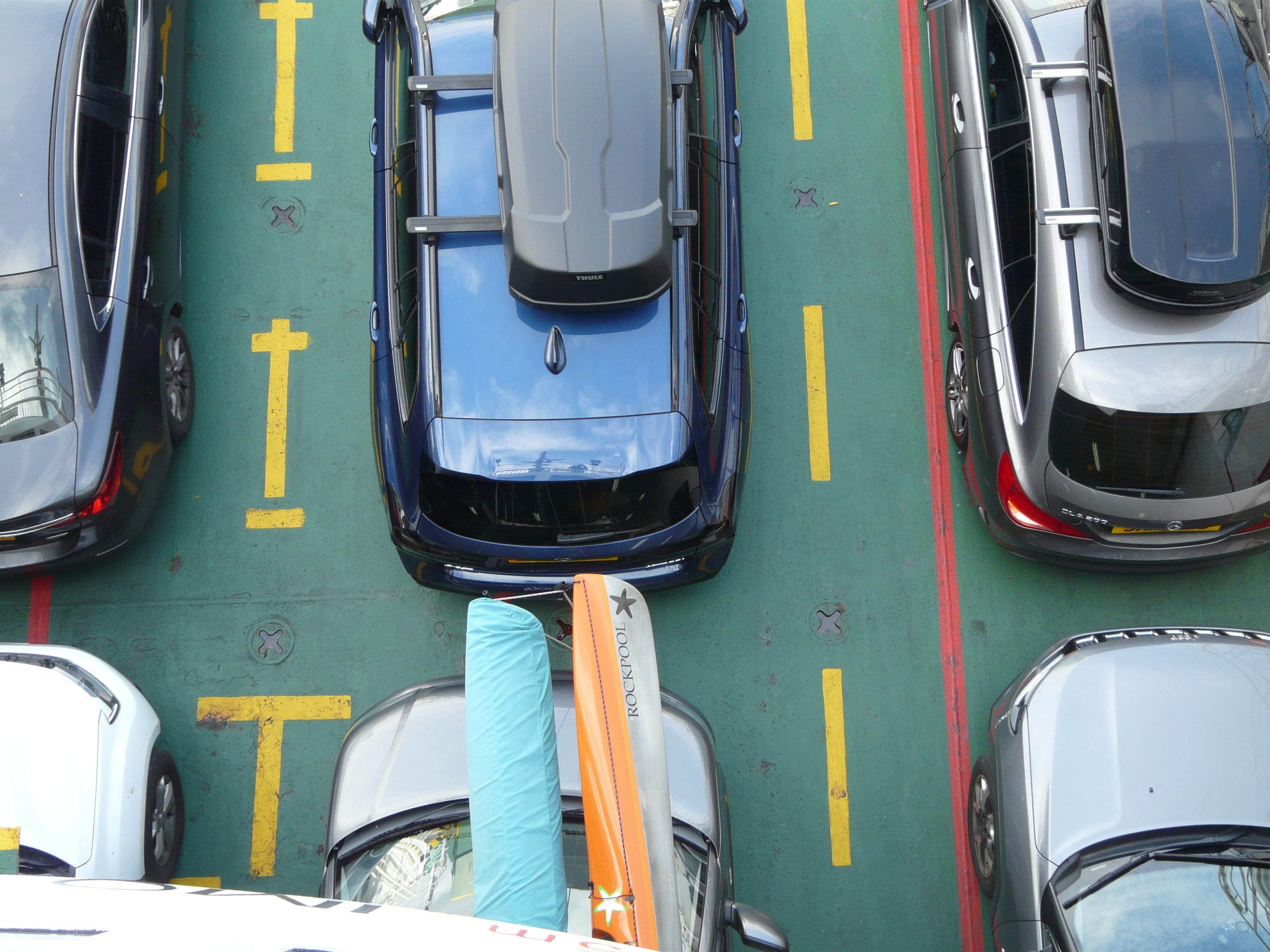
Eventually a sneaky weather window appears and we step off a last-minute ferry in the Sound of Islay.
It really is last minute. We arrive on the evening ferry and tides dictate an early-o’clock start the following morning. After a quick visit to check the intended get-in, it is time to sort kit and get to bed. After a year of preparations somehow you still run out of time at the end!
Conditions
The forecast isn’t perfect, but not too bad: a not-quite 10 mph breeze from the NNE with a gentle 1-2 ft swell on the west coast, all under a gunmetal grey sky. Sunny spells are forecast for later, with the wind going easterly. This may give a little headwind along the north coast, but at 10 mph that’s tedium rather than problem. I expect a bit of chop in the Orsay tide race with the swell, but all in all it’s good enough to get around.
Starting Out
The Islay lap length is roughly a multiple of the tide cycle, so on paper this gives a bit of variety to start points without affecting the tide timing too much. That said, limited road access, geography and the desire to transit the OA and Orsay tide races at the start of the day narrow down those options.
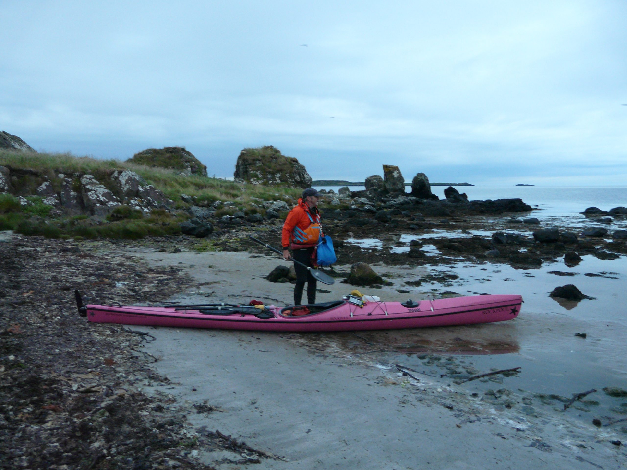
I’ve plumped for a start point at the small rocky island of Texa, after a short paddle in. This gives an easy launch, an obvious timing spot and ticks the tide race timing box too.
I get on at a small, scruffy beach, as the spraydeck goes on the stress falls away. I feel at home, we are finally here, the day is underway.
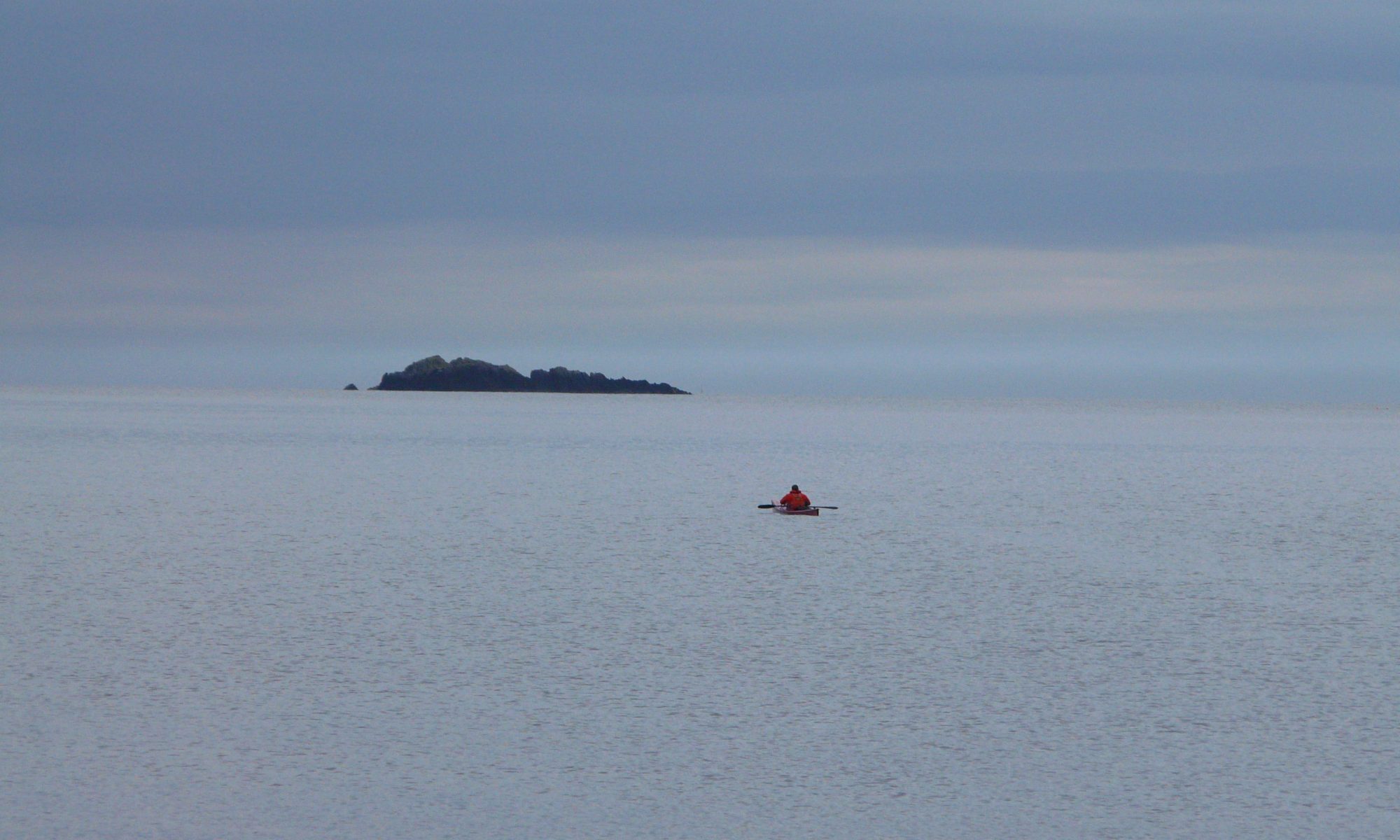
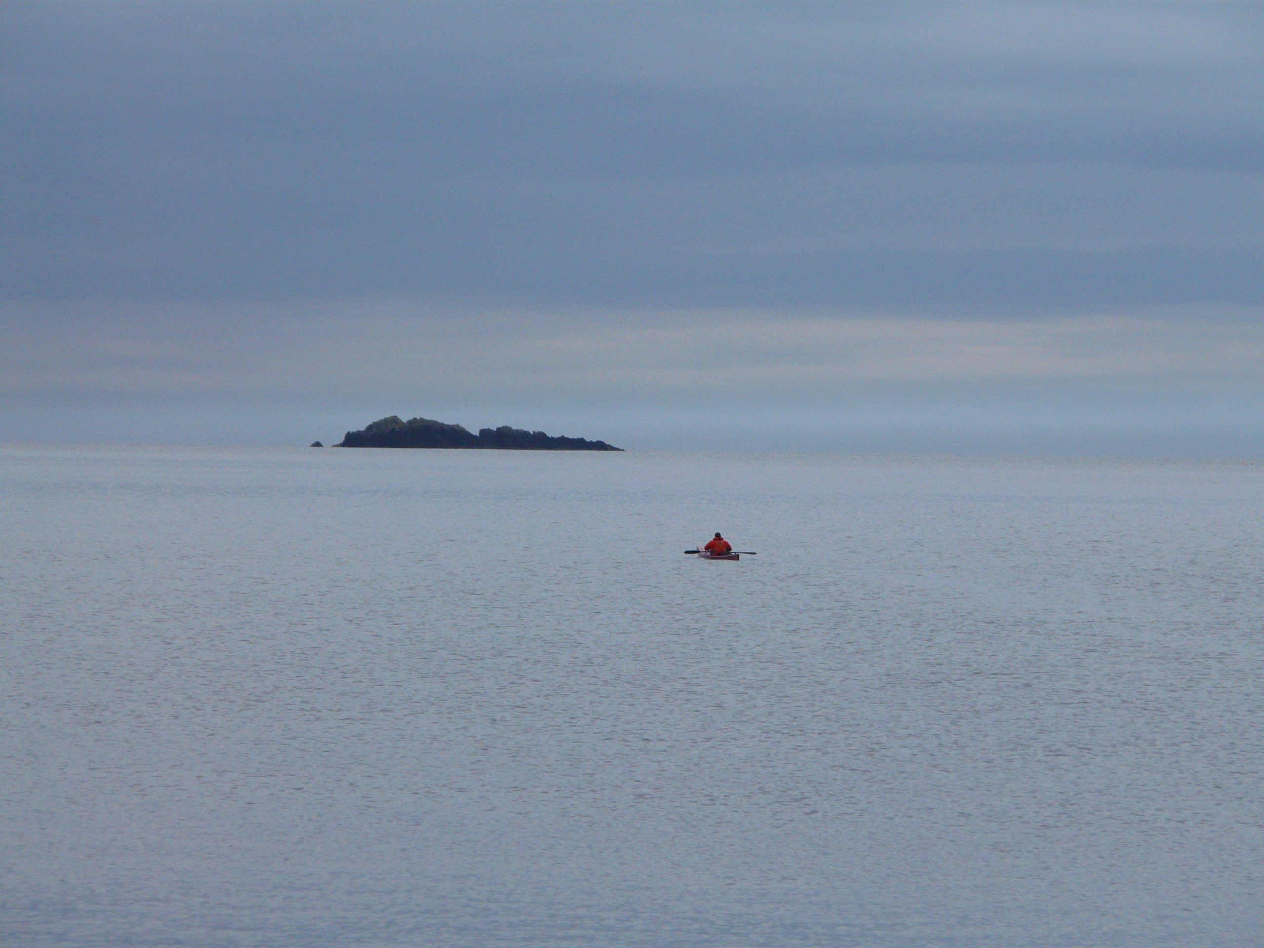
A few minutes later I reach Texa, just offshore. It is reassuring that the forecast is as predicted. Boat and me turn south-west, I start the watch and paddle. We are off.
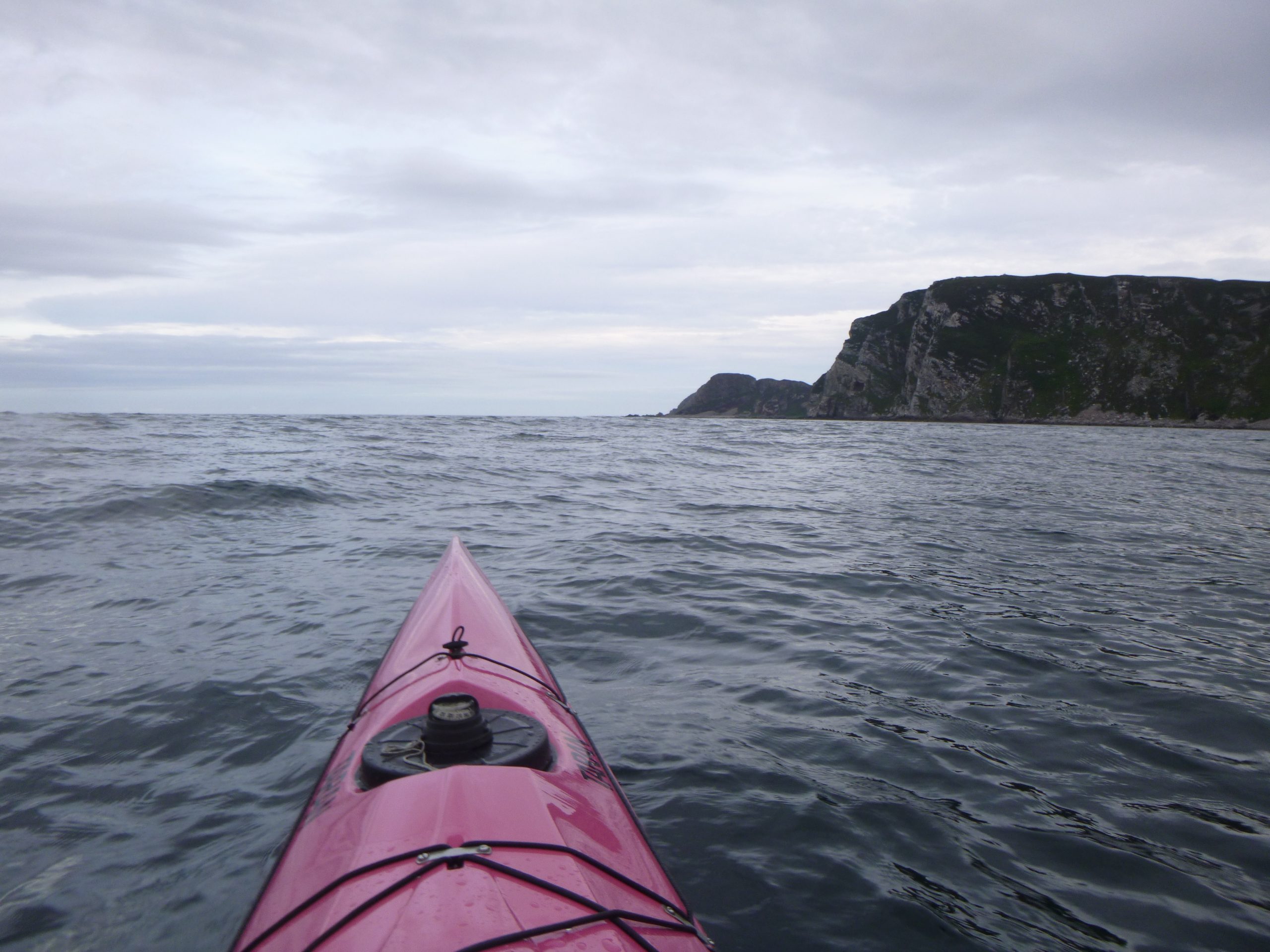
The first hour is uneventful, which is just as well as it takes me a while to wake-up this early morning. I arrive at the end of The Oa headland, just as the tide starts to run. The swell is nudging the tide race gently awake, but it is having a slow start too. I take in the scenery along the cliffs as I drift through while munching on an egg butty. Life is fine.
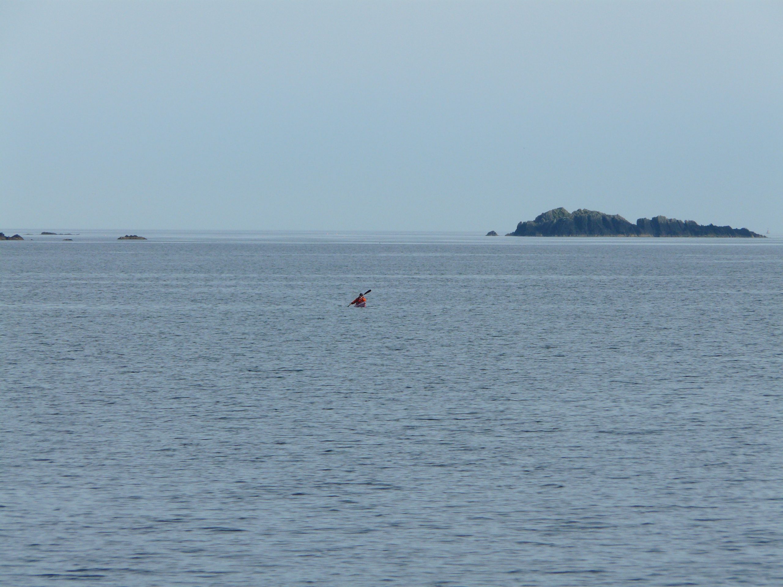
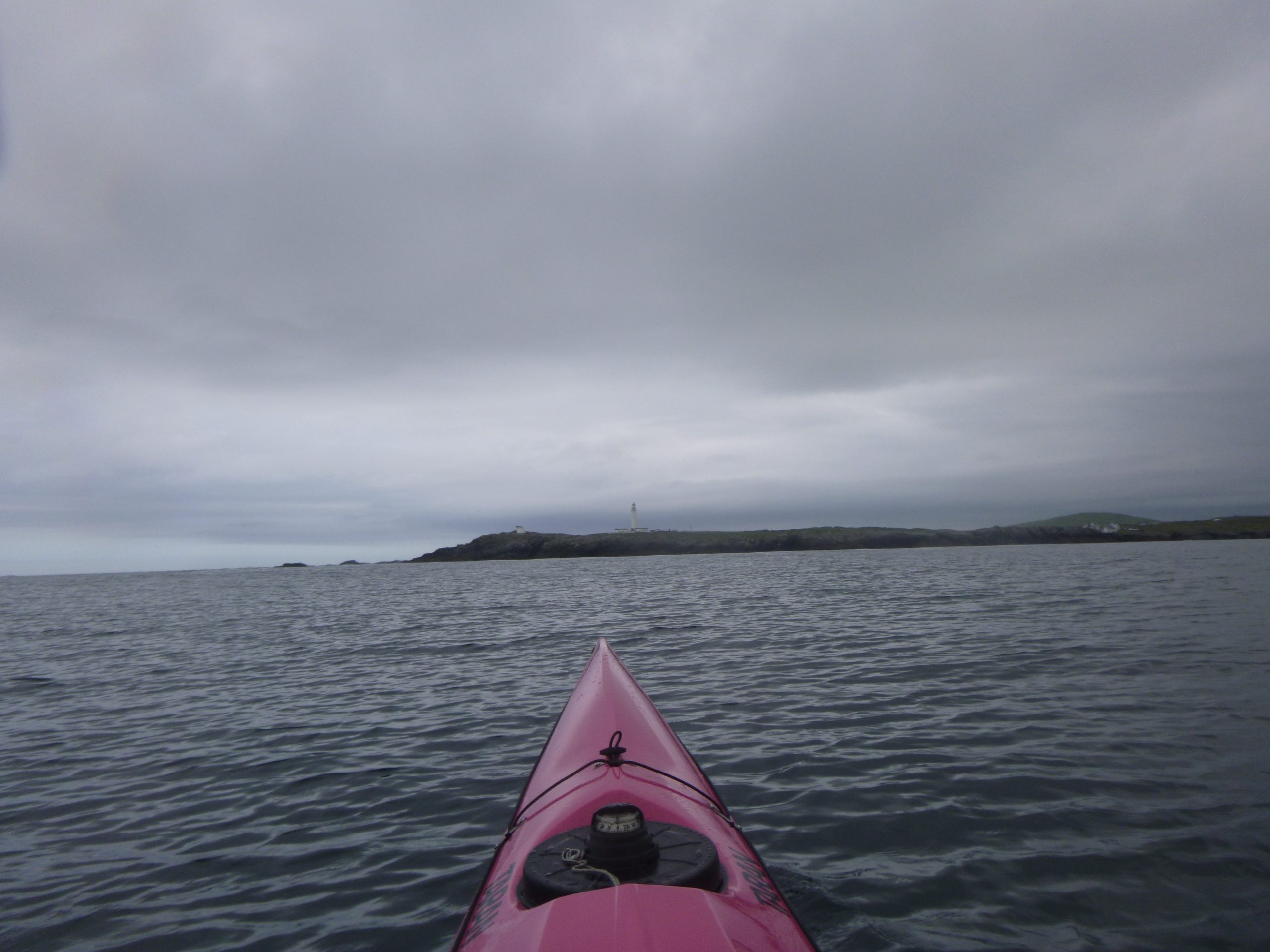
As I round the headland, my heading goes from SW to NW and I point towards another headland – The Rhinns of Islay. For now it’s just a low-lying grey silhouette in the distance, 8 miles or so across the bay. The breeze is still NNE, a slightly-off-the-nose gentle headwind. No hassle, crack on.
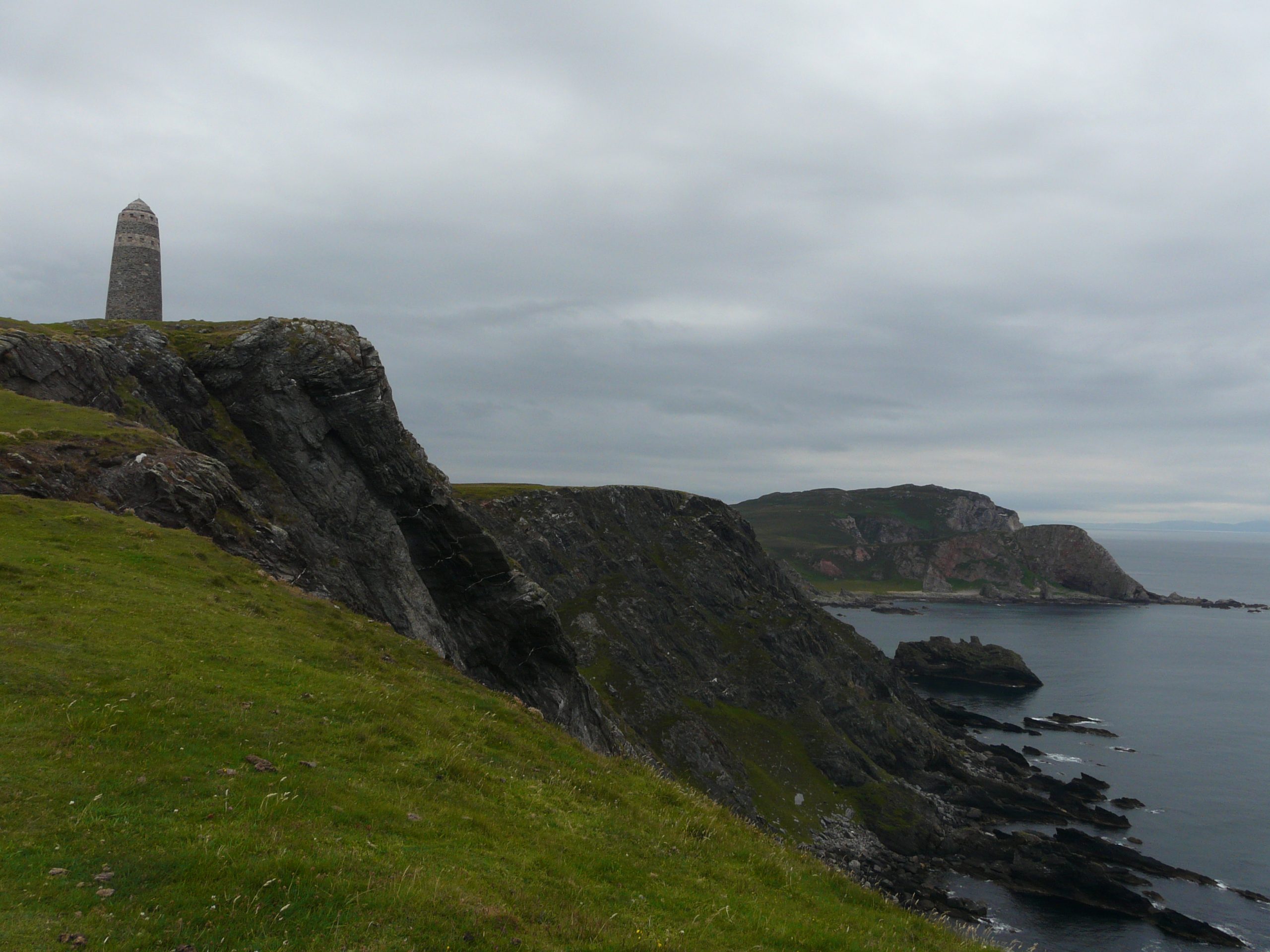
The Boss waves from the American Monument atop the cliffs as I go. 8 miles slide by.
Orsay
“𝐵𝑒𝑐𝑎𝑢𝑠𝑒 𝑜𝑓 𝑜𝑣𝑒𝑟𝑓𝑎𝑙𝑙𝑠, 𝑏𝑜𝑡ℎ 𝑡ℎ𝑒 𝑂𝑎 𝑎𝑛𝑑 𝑡ℎ𝑒 𝑅ℎ𝑖𝑛𝑛𝑠 𝑜𝑓 𝐼𝑠𝑙𝑎𝑦 𝑠ℎ𝑜𝑢𝑙𝑑 𝑏𝑒 𝑝𝑎𝑠𝑠𝑒𝑑 𝑎𝑡 𝑎 𝑑𝑖𝑠𝑡𝑎𝑛𝑐𝑒 𝑜𝑓 𝑠𝑒𝑣𝑒𝑟𝑎𝑙 𝑚𝑖𝑙𝑒𝑠.” Clyde to Colonsay, Martin Lawrence
Approaching Rhinns Point I am anticipating the overfalls. With the forecast and the conditions so far I’m not expecting too much hassle, but you never know.
There are 3 options:
The first is the ‘chicken chute’: the inside channel between the close-lying island of Orsay and the Islay ‘mainland’. This will likely be the smoothest option, sheltered from the swell on the whole but it has the downside of dumping you unceremoniously into a large eddy before Frenchman’s Rocks – likely with a long time-consuming slog at the end.
Next is outside Orsay, in the narrow gap between Orsay and the small off-lying rock of An Coire. This sneaky line goes along the northern edge of the tide race, and gives an option for a breakout behind Orsay in the event of any non-too-happy moments.
And of course there is the full-fat version of straight down the middle, come what may.
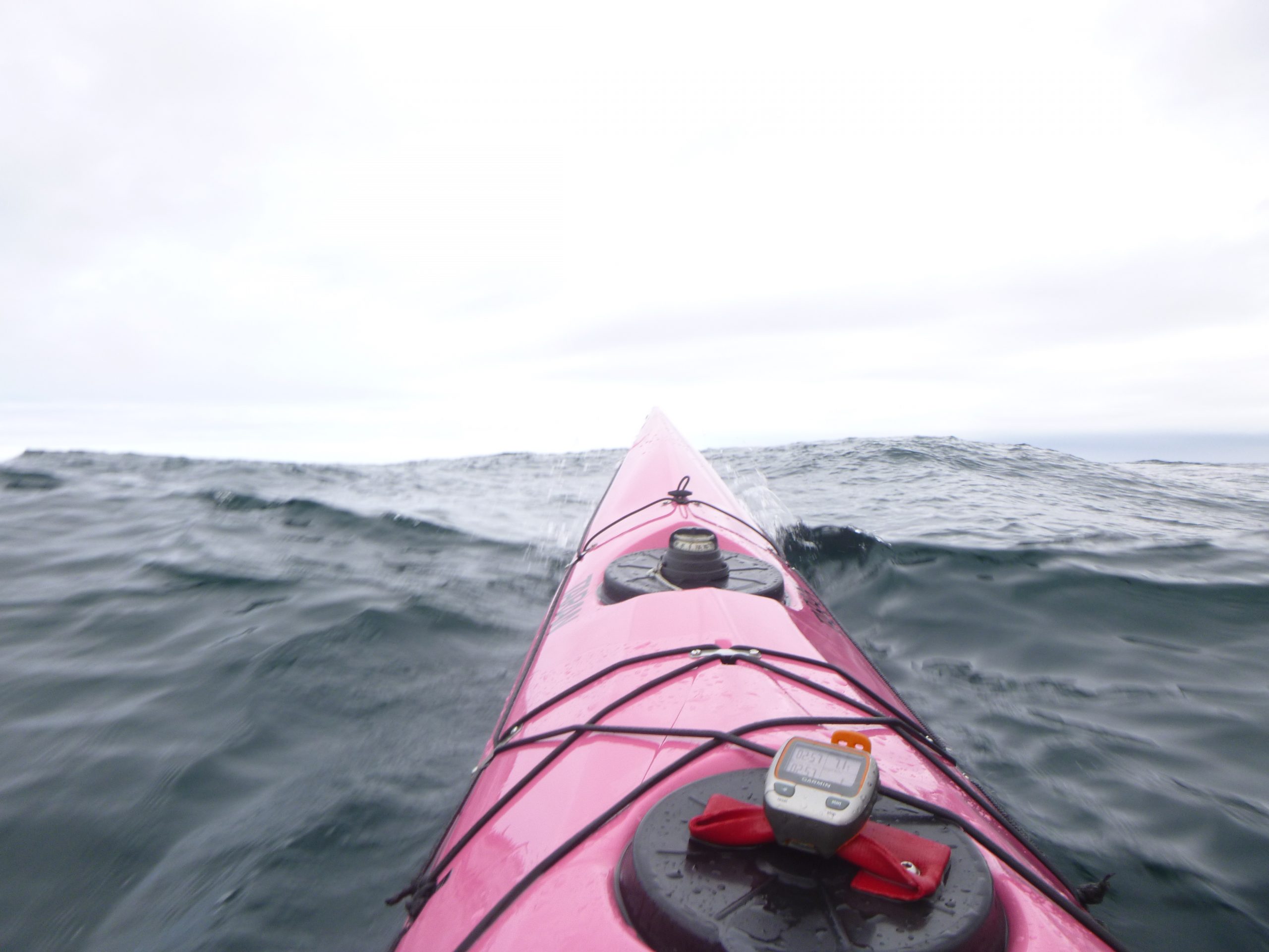
From a distance there is movement in the tide race, but it’s difficult to judge the scale. So my plan is to go for the second option – with a plan to alter either way if need be. However as I close on the island, there looks to be quite a lot of confusion and white-stuff in the gap. It is too late now to go for the inside route, so I ease out to take the full-fat option instead.
The GPS shows the speed increasing as I enter the tide race, it is a bit splashy here and there and a few heading-change and timing-adjustments are needed to avoid the splashier bits. I’m 3hrs in with 10 to go; there is no need for any more excitement or dampness than is necessary.
While the conditions in the Orsay overfalls are not dramatic today, the scale is impressive. They go on, and on. After an hour they’ve settled a touch, but I’m still paddling through the arse-end of it all. The boat rises, falls and wallows around. A smooth glide is not part of the programme here.
It doesn’t seem overly significant just now, but I know these conditions have an invisible fatiguing affect. Later you wonder why you run out of steam.
It isn’t Mull
The coastline has a few lumps, bumps and sticky–out bits, but is fairly featureless on the whole. In the distance lies a dark silhouette, it’s a long way away and I hope it’s the far-off island of Mull, and not the right-hand turn at the top of Islay.
It isn’t Mull. It is right-hand turn at the top of Islay. Wow, that still looks a long way away. It takes a while-of-denial, before I allow the dawning realisation to take centre stage.
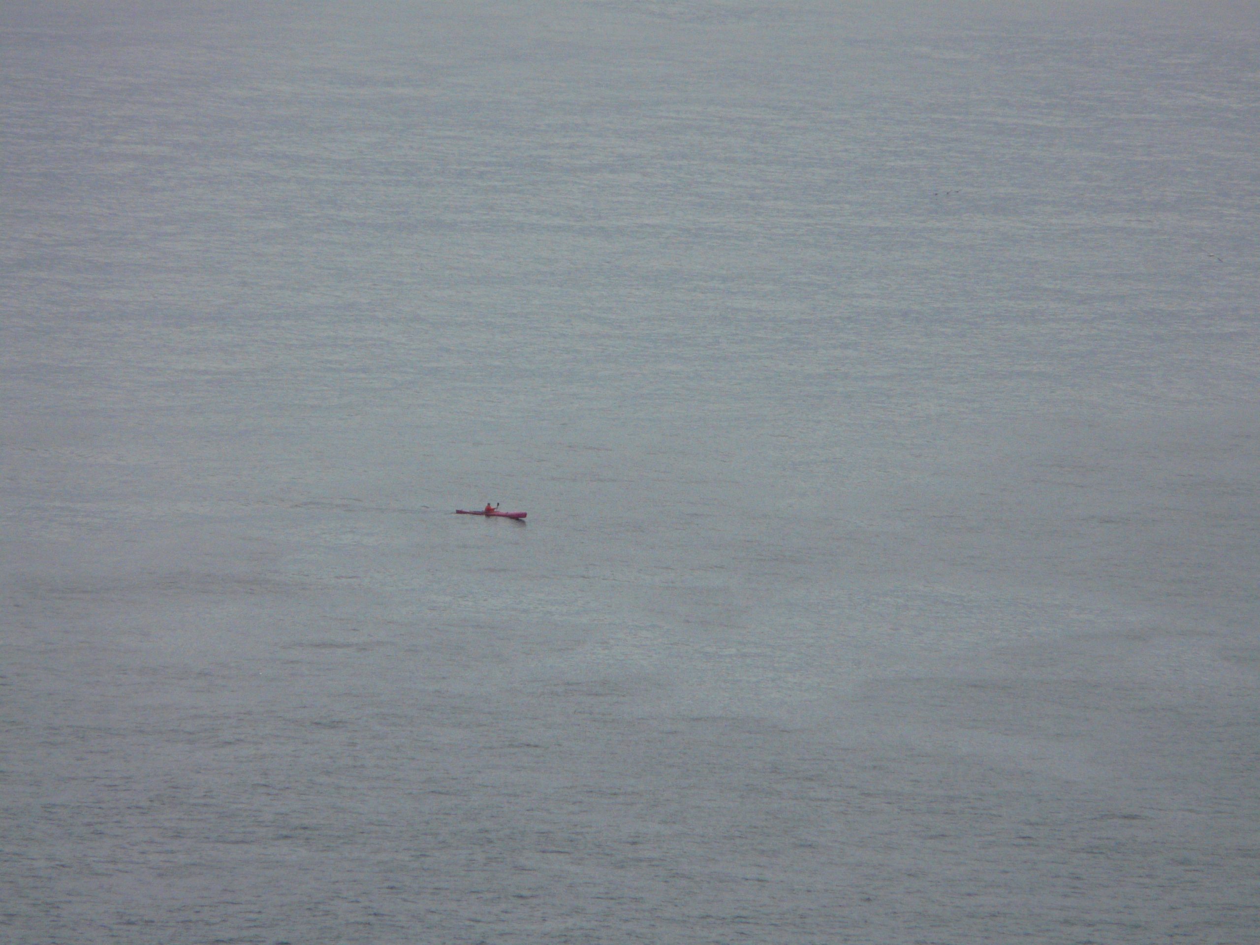
In the meantime I prefer to get distracted by a visit from a pair of Minke whales, along with the view of the pretty sands of Machir Bay, though they are a little too far away to be appreciated fully.
Next there is another tide race off Coul Point. This one seems a little white from a distance, and as I close I can hear it too. But it’s all talk, when I arrive there is no drama.
The west coast tide races have made a smooth paddling routine difficult, but they have added a bit of speed to the day. Nearing the ‘top left corner’, a few calculations suggest a sub-12 hr finish may be possible. Nice!
Right Hand Down
Off An Clachan I turn right and head east, towards the northern end of the Sound of Islay, though it is still 12 or 13 miles away. I hope I might make out the ‘friendly faces’ of the Paps of Jura by now, but they lie behind higher ground on Islay. Colours are muted and the horizon a little murky. It’s still grey.
On turning the corner the speed drops too. It is what the plan says, but still disappointing when it happens. The wind has gone to the east now, a little earlier than hoped. There you go. Pick a headland and paddle towards it.
By Nave Island I’ve been on the go for 6 hrs and I’m starting to flag a little, not too unusual. Nave Island means I’ve reached half-way around, distance-wise. I’m not sure if that is a good thing or not.
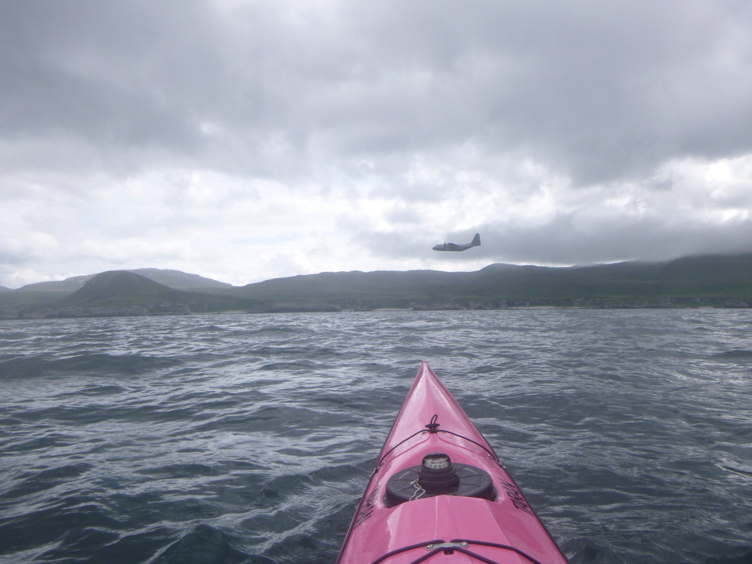
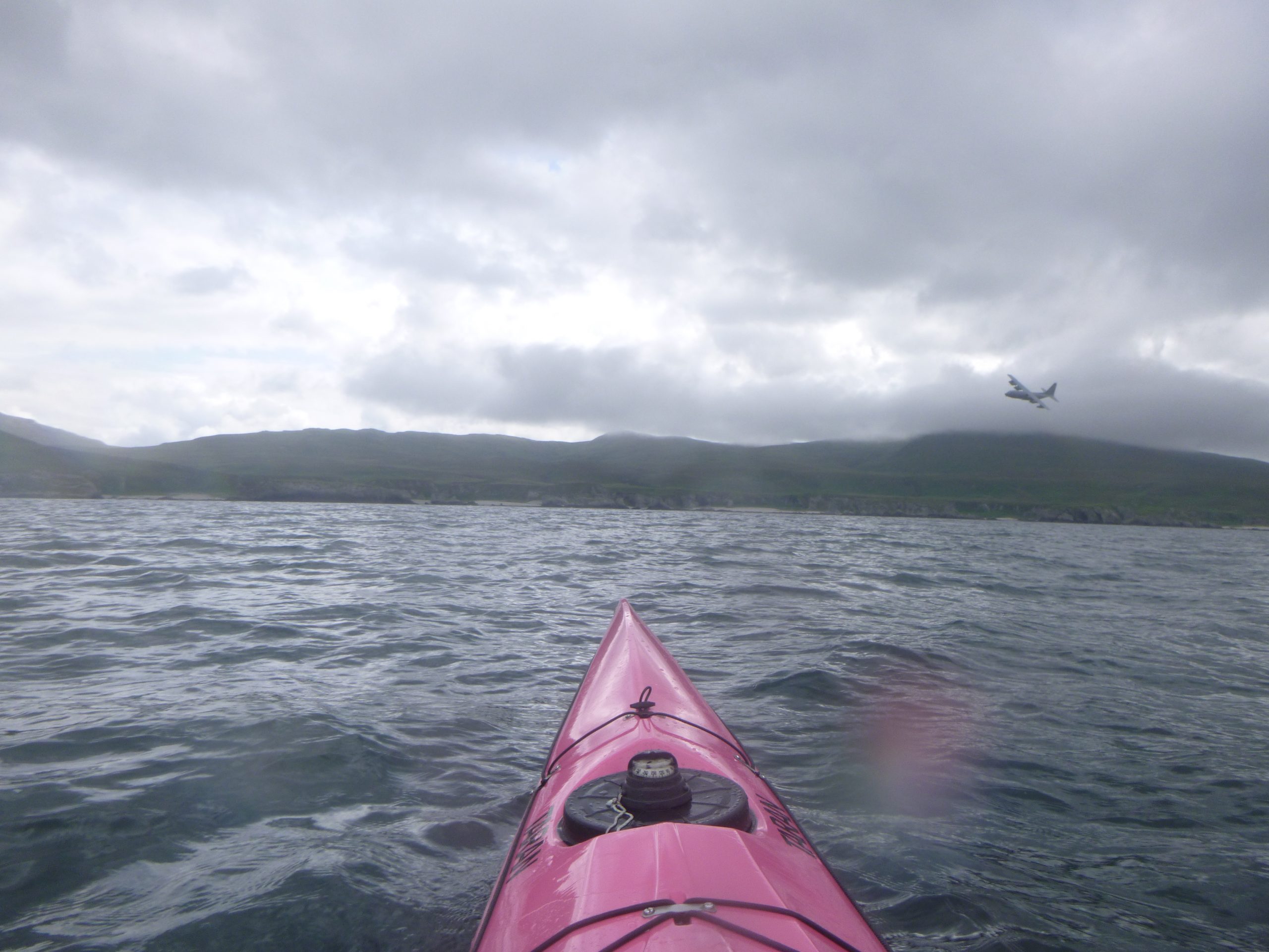
Another hour goes by, it’s still grey and I’m still flagging. It’s a lonely stretch of the coastline. Then, as I near Rubha Bholsa, a C-130 Hercules aircraft flies by. They bank left and take a minute to go around to for a second look. The crew waggle the wings before heading off east, it lifts my spirits surprisingly. Life doesn’t feel quite so lonely for a while.
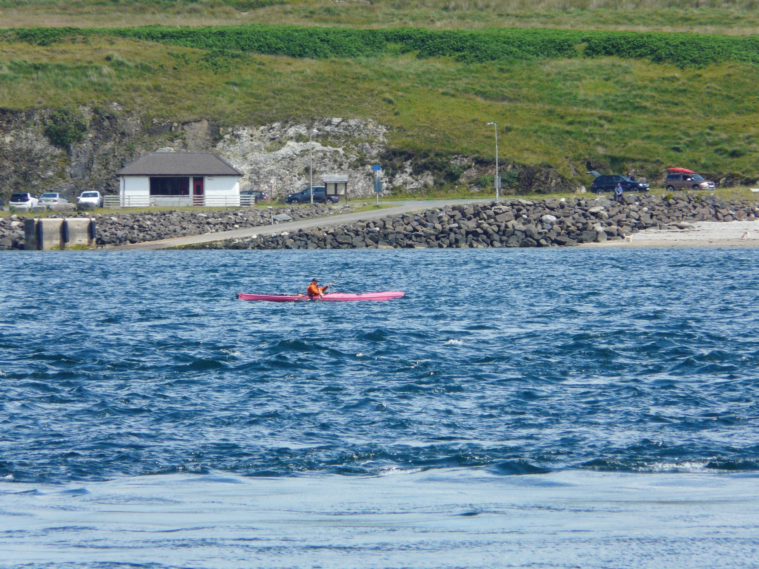
Admin Stop
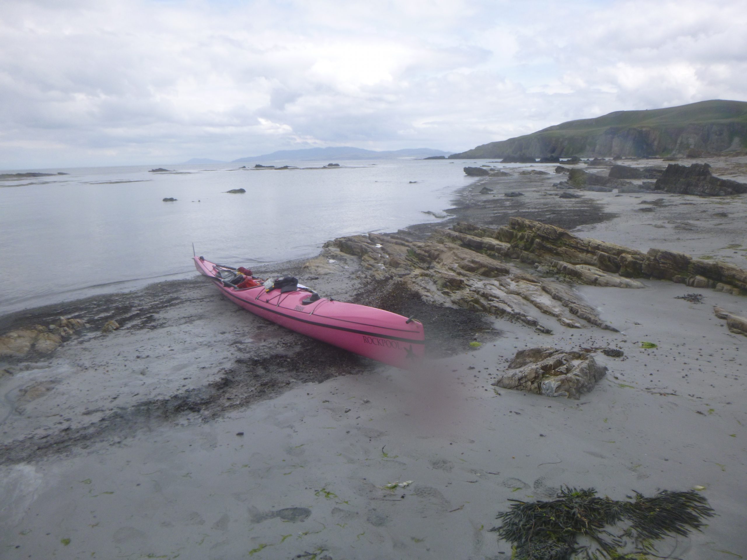
The plan was to stay in the boat for the full day, a long stretch but not impossible. However today it’s not to be. A toilet stop is needed, and a pee-bottle isn’t going to work for this one. I need to land. I know this will cost me twenty minutes but that’s life. So I head in to the isolated beach at Bàgh an Dà Dhoruis for a break.
It’s a pretty spot for admin.
I’m in the middle of nowhere, the map shows 3 miles to the nearest road, but of course just as I bare my bum to the only-me-and-a-few-sheep world, a quad bike appears on the high ground above the beach. It’s one of those days…
While on the beach I take the opportunity to stretch my legs and change into dry clothes too. That feels good. Back in the boat, it’s now only a short paddle to the corner where I turn right once again, to head south into the Sound of Islay.
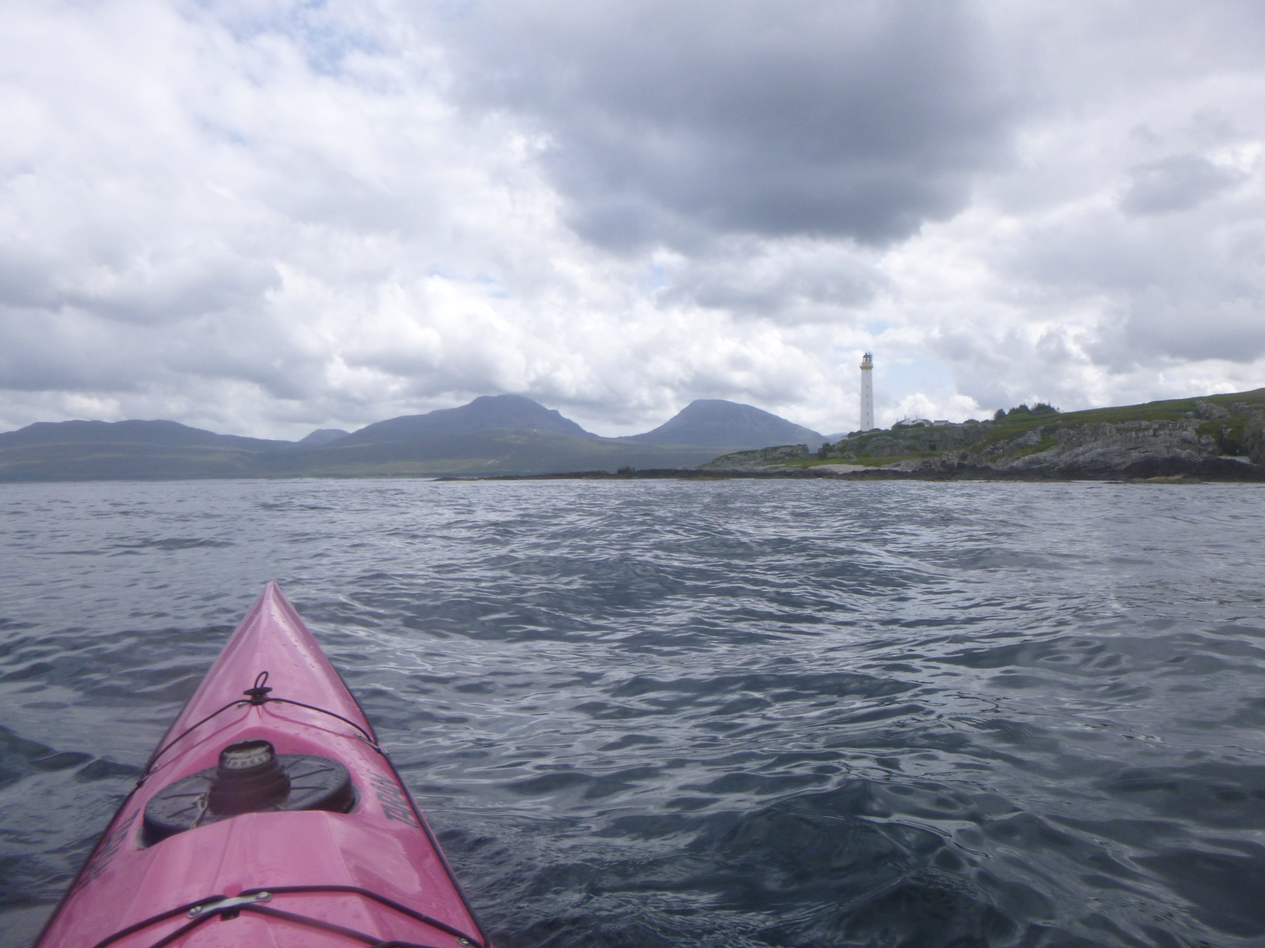
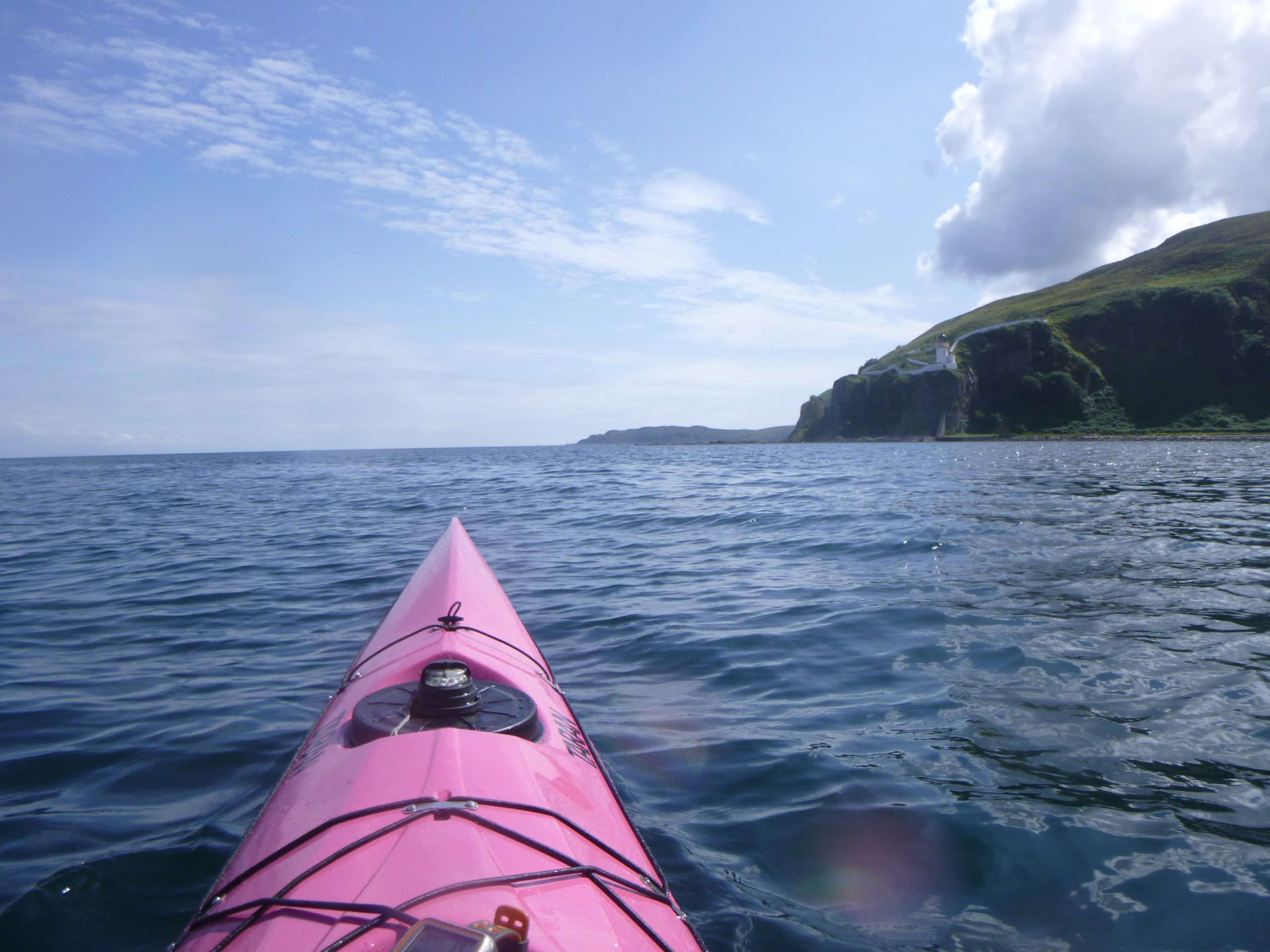
The Sound
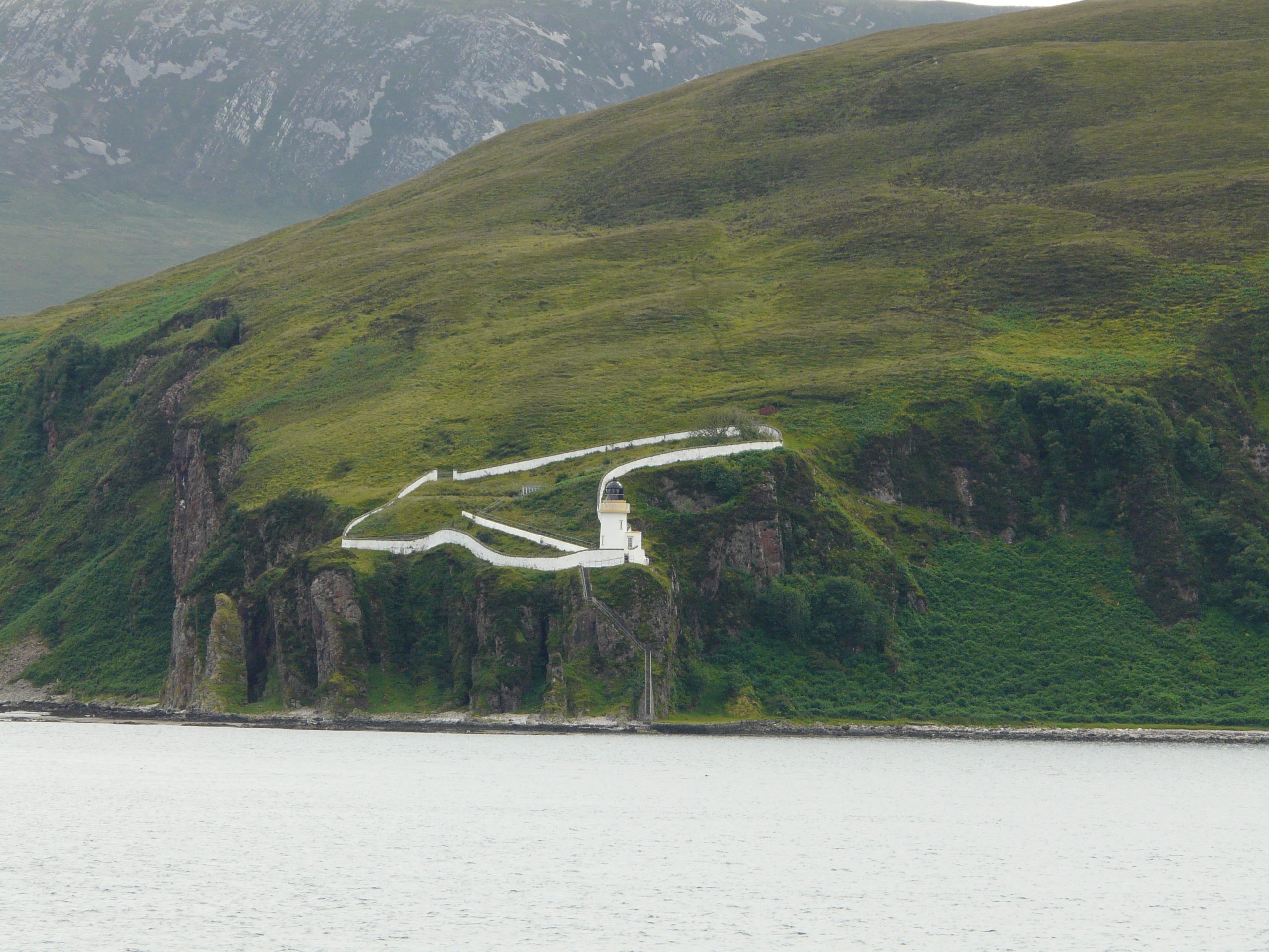
As I round the corner I can see the impressive mountains of Jura now at last. The flow is squeezing nicely into the mouth of the channel, and as I pass the lighthouse on the corner I’m moving nicely at 7 kts. All this is punctuated by my first glimpse of blue sky for the day. Spirits lift once again, this time as I head south, still with 7 kts + on the GPS.
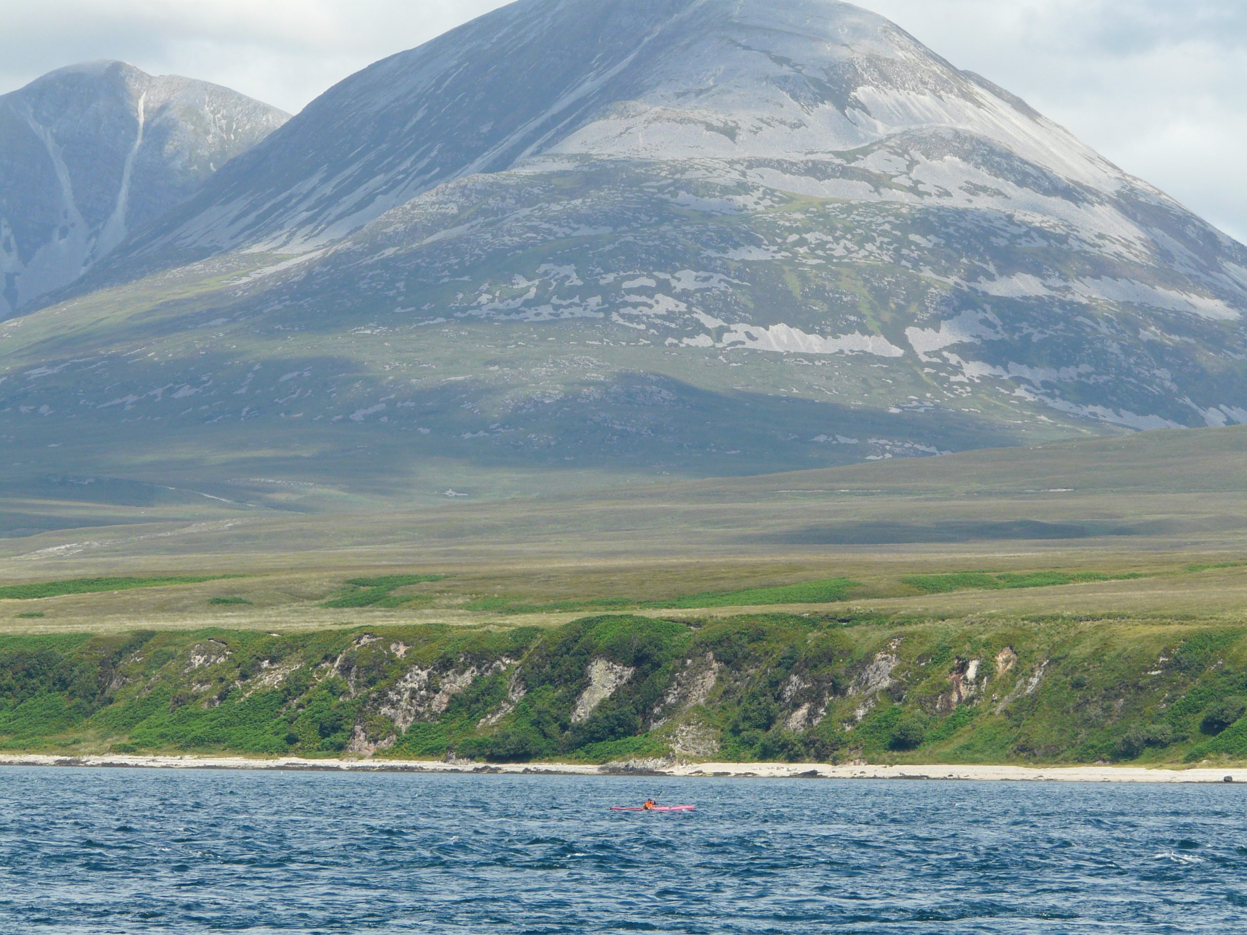
The sun comes out and colour vision returns. The silver-grey Jura mountains look large and spectacular over to the side. While Jura may seem to reside in the shadow of its larger neighbour, Islay, it defiantly shows off impressive scenery to make a point.
There is a faff as the camera shows ‘memory card full’ (school-boy error) and eventually I give up trying to remember how to delete pics to make some space. The impressive views of Jura pass by, hauntingly unrecorded.
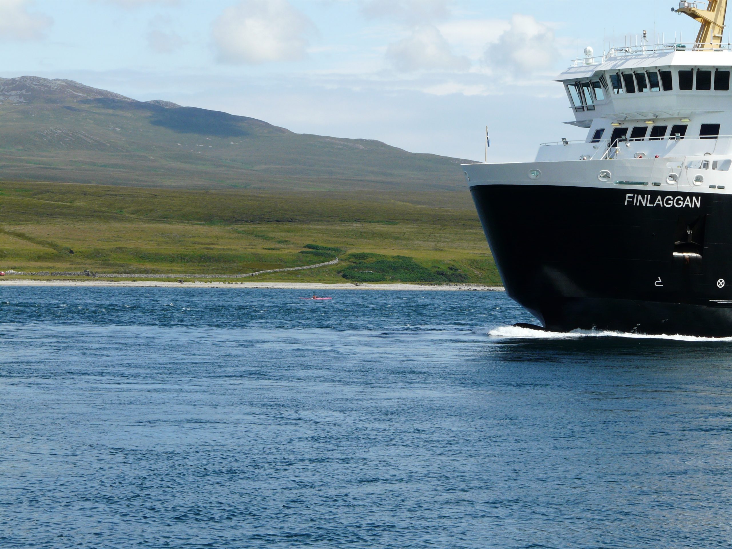
Unfortunately the sunshine brings a strengthening wind blowing up the sound. The wind makes things a bit splashy down by the ferry crossing, but under the sunshine I hardly notice. Boat and me are making good progress, nearly 8 kts now.
It’s a relief to pass the incoming Islay ferry without incident, and assuming she sticks to the timetable I can ‘bomb’ down the middle of the sound for a while without fear of being run down. As the sun warms my arms I take in the Islay scenery along the remote stretch of coastline. Ahead in the distance I can make out the Kintyre Peninsula (I guess).
Life is good.
McArthur’s Head
But whenever life is good, it can only go one way of course. At McArthur’s Head I pass the isolated lighthouse perched precariously on top of the small cliff, and watch the speed drop off that cliff.
Perhaps I cut the corner too tight? But I can’t see any obvious flow further out, not without going out a loooong way.
There is a matching fall in my mood too. The psychological affect is striking; suddenly my energy levels drop to match the drop in boat speed.
So I slog along the coast, vainly trying to scrounge a little flow. It is pretty here and the sun is out, but I am tired. The headwind is only a breeze, but it drags like a hurricane. It’s 11 hours since the start.
Claggan Bay goes on forever, and then a bit more. I admit defeat trying to find any flow. The GPS shows a sluggish flat-water speed only. I guess that is how it is going to stay now.
Ardmore Point follows in a brain-fuddled fatigue of well-is-it-or-isn’t-it-Ardmore? However it is, and soon there is nothing remaining in front of me, so I figure it is time to turn right for the final time, to head onto the final stretch – towards Texa.
To Texa
The wind drops and the day has that evening stillness about it now. It’s calm, peaceful and pleasant.
The route here is a little more involving, low lying islands and reefs abound. I opt outside the first ones but then skirt through the gaps in front of the pretty green headland of Aird Iomarsaigh.
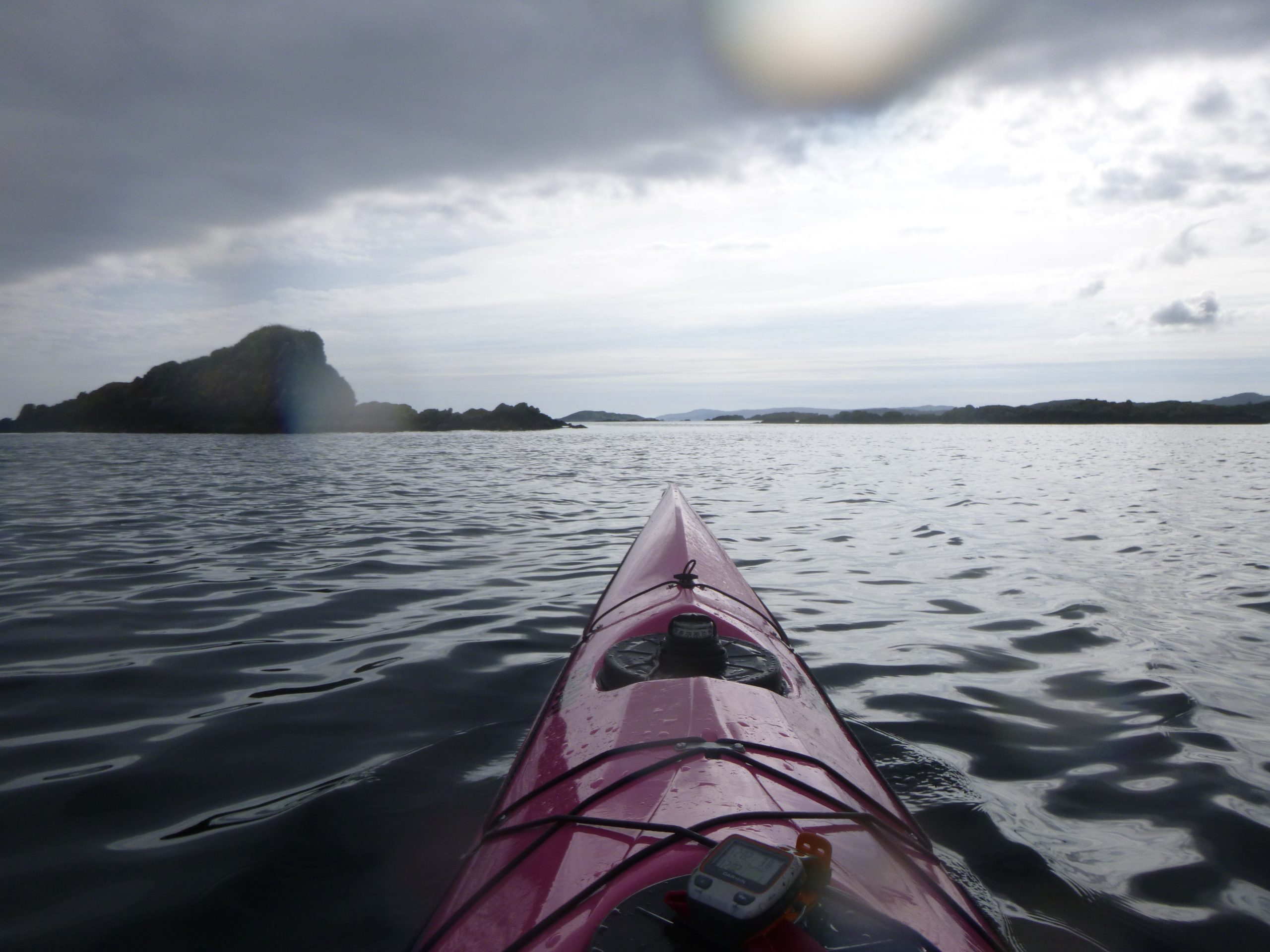
I try to put on a ‘bit of a burn’ for the final stages, but not much happens and I figure it won’t make much difference anyway. I aim for the sun-bleached rock of Texa, but it feels like I’m frozen in time. It doesn’t get any closer.
The final ¾ mile along the island takes even longer, but all of a sudden I pass through the rocky gap where the clock starts and finishes.
Abruptly it’s all over. Job done. 12 hrs and 40 minutes.
I drift for a minute and take in the view one last time – it’s nice. Then I turn tentatively towards the Islay shore, for a further 15 mins of adding-insult-to-injury paddle to the beach.
It’s been a long day.
In fact, it’s been a long year.
But it worked.
John Willacy
Oct 2022