Off to the Skerries once again, and why not? The sun is out after all.
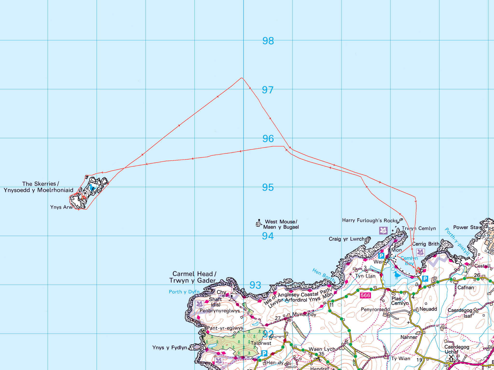
The norm is for a left turn out of Cemlyn Bay, and go with the flow until you hit something.
Hopefully before Ireland.
But today we want a little more from the day. We are going to practice a little seat-of-the-pants moving water nav. No compass (it won’t help that much anyway), no GPS, no nowt. Just what you can see, what you can feel, and what you’ve practiced.
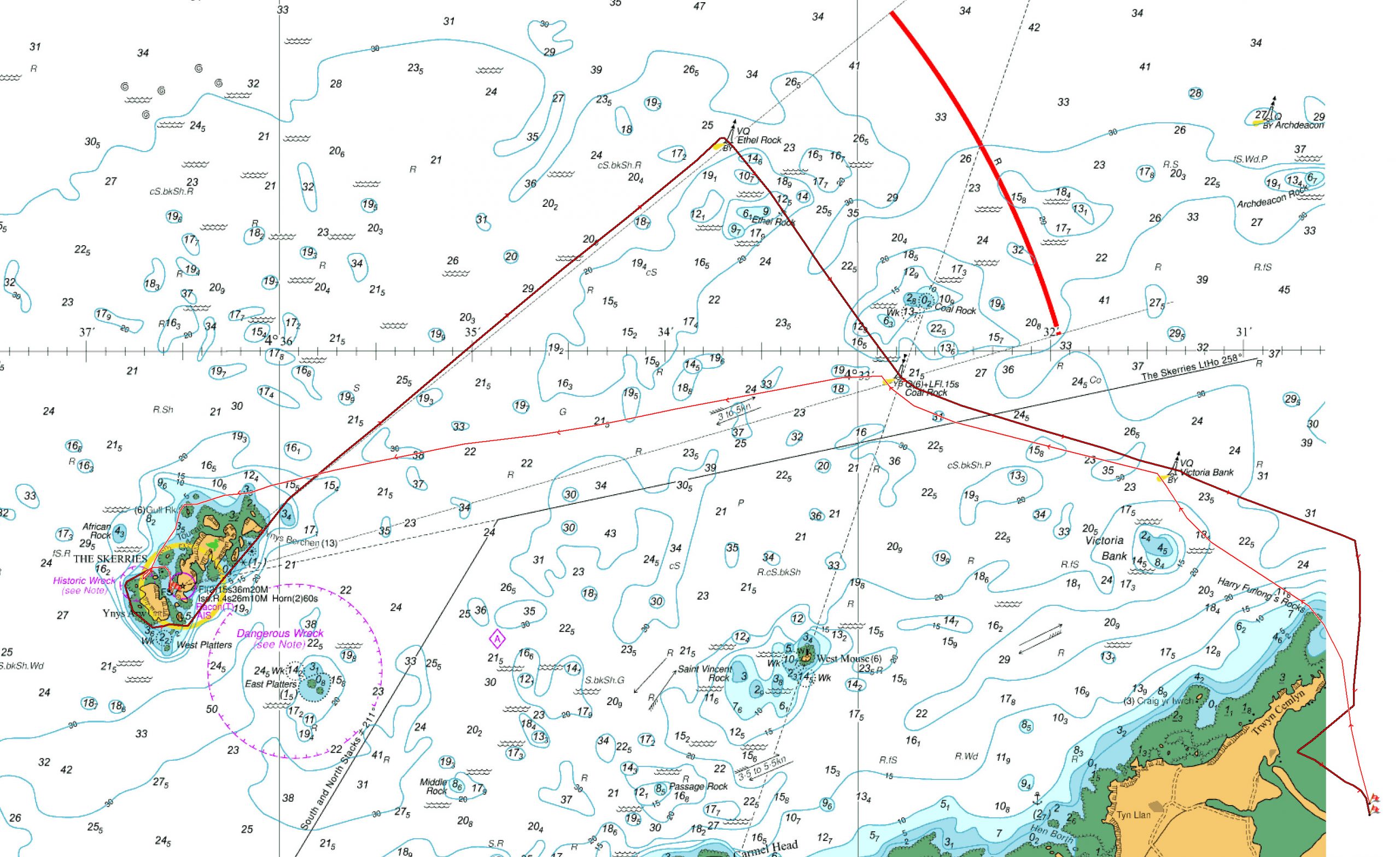
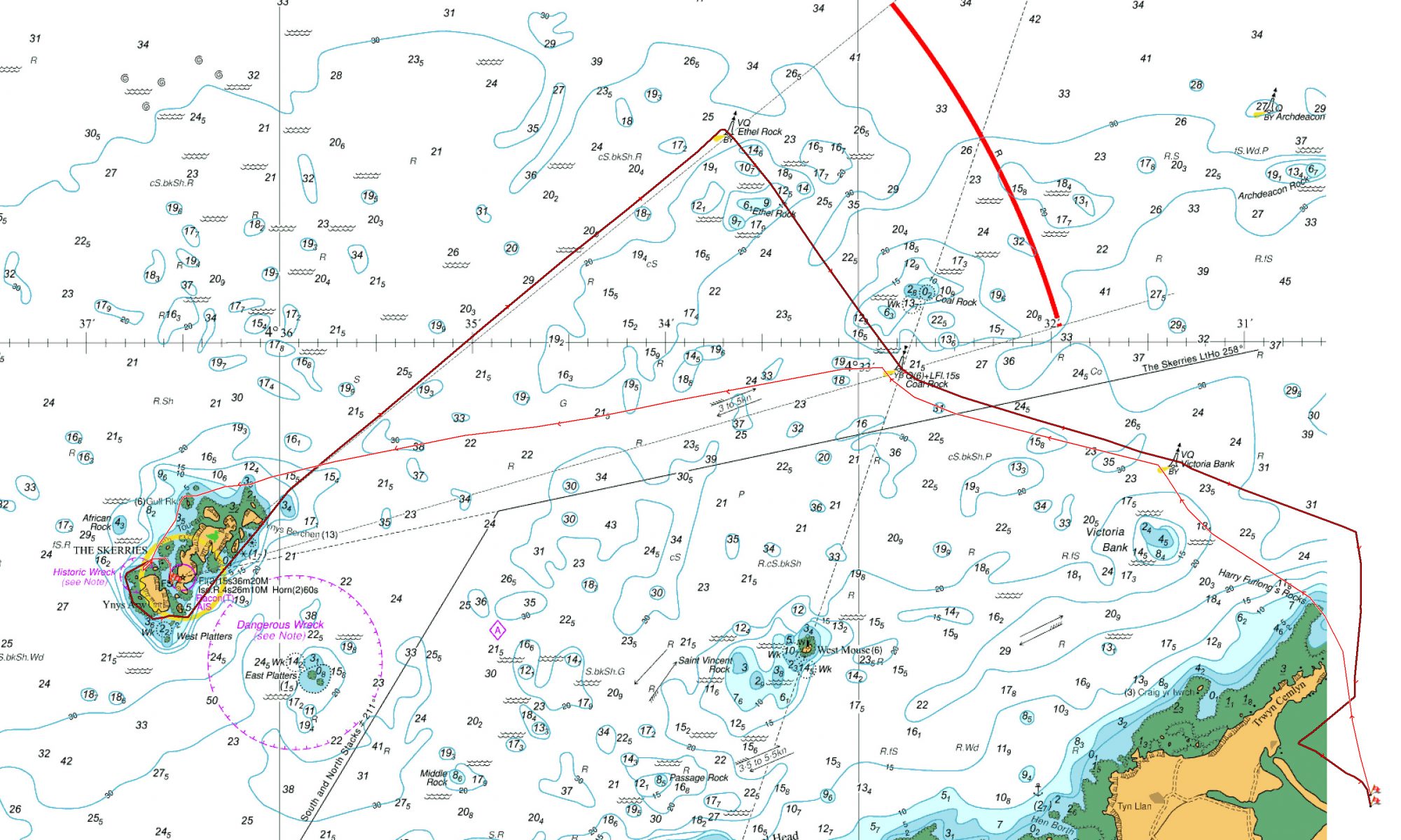
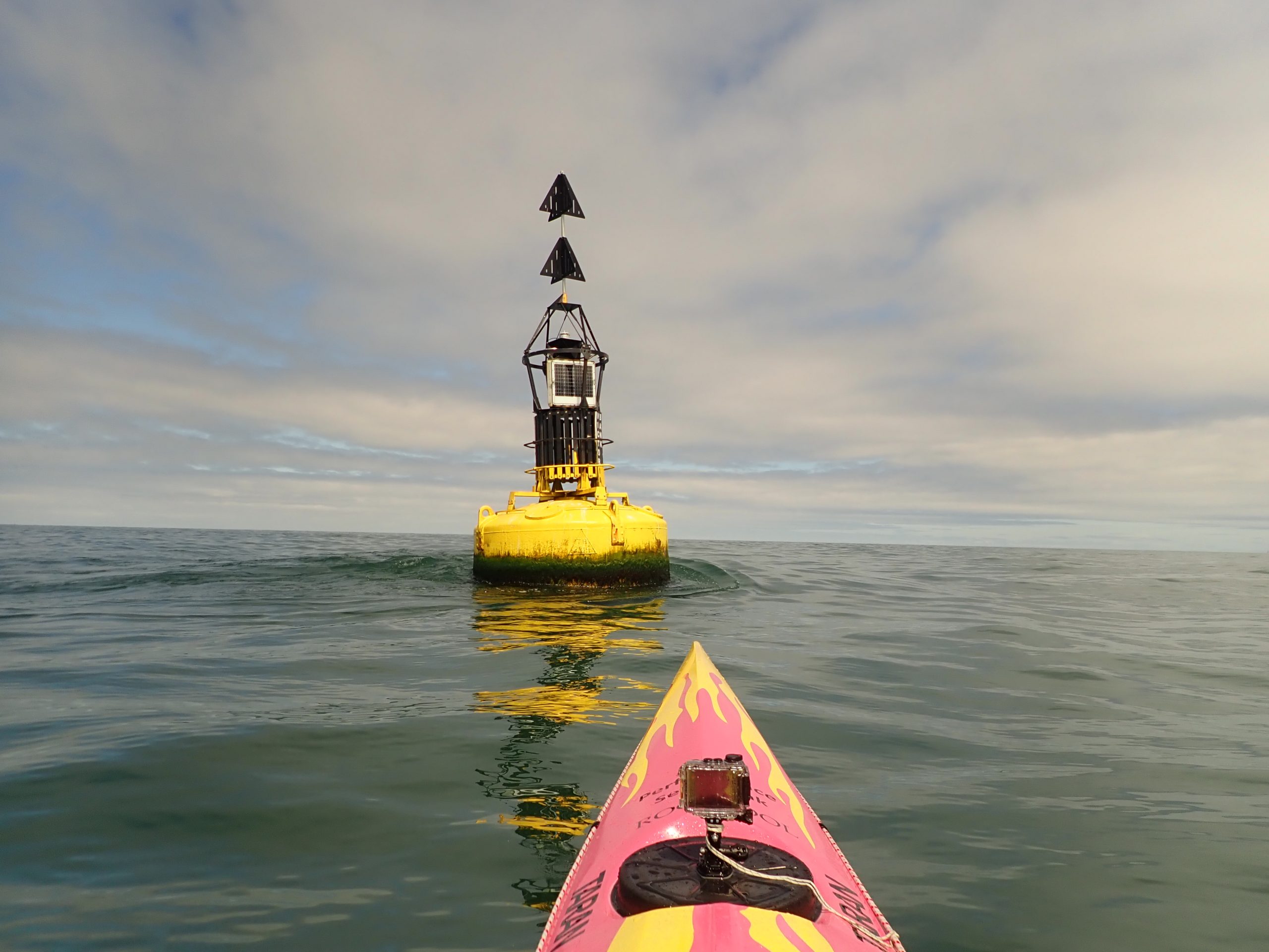
It’s late ebb but there’s still some flow. On the way out we’ll take in the Victoria Bank and Coal Rock buoys respectively. These will mean a bit of angle across the flow to reach the buoys.
No 1 + No 2
The first is straightforward, and to be honest the cushion from Coal Rock does a chunk of the work for you. Cross close in behind the buoy – #1 down, nicely.
To Coal Rock the flow is a little faster and a little more across – a falling-ferry onto the buoy. Once again the aim is to get in close behind – 1/2 boat length is the aim. Line it up early, set the angle and power and try to paddle with the minimum of corrections. Allow for the last minute ‘speed-up’ as we near the buoy, and Uncle Robert is on the family tree somewhere. Nicely we cross behind the buoy – #2 down.
No 3
We are going to save #3 for the return journey, so for now we turn towards the Skerries, and straight-line it for the N side of the rocky, lighthouse-clad lump.
All goes well, we arrive in time for lunch and bask in the sun, viewing the seals and puffins. Life is good.
In reverse
For the trip home it’s time to lift the game a little.
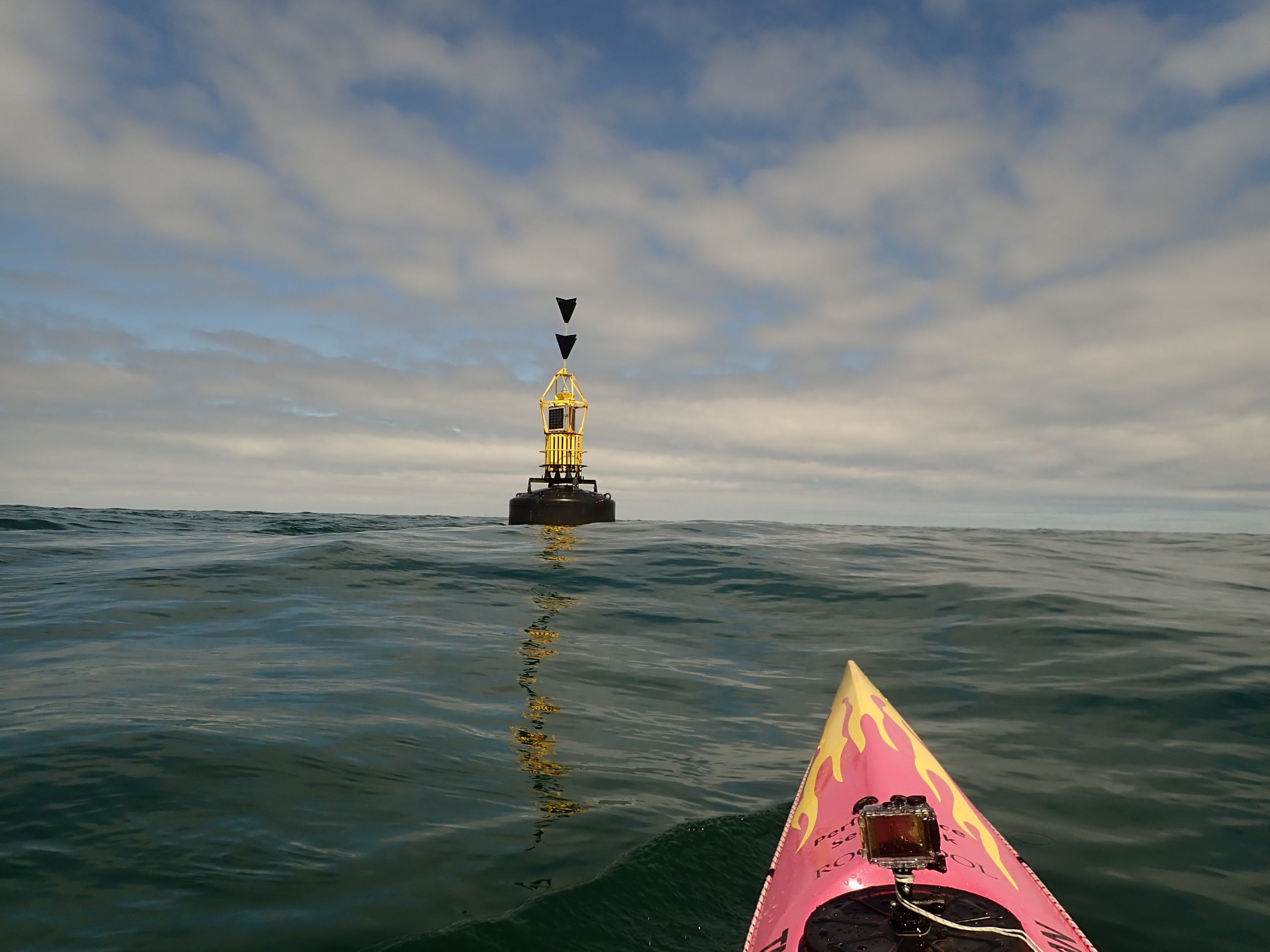
First of all we start with a little psychological game. We head ‘out’ to the Ethel Rock buoy. It’s not that much further out than Coal Rock (just over a mile). However that northerly component in the boat angle, away from the distant shore, encourages surprisingly doubting voices to pop into your head.
But we’ve done it before, we have experience, training and a few strategies to calm those mental skeptics.
Ethel’s Ferry
So ‘Ethel’ arrives nicely, as she usually does and now the real work of the days starts – a 1nm square-on ferry to Coal Rock buoy. Once again this is all done visual, or that’s the plan. I can’t make out the buoy in the distance, it’s lost in the rough backdrop of the distant Anglesey coastline.
No stress, I ‘reckon’ it’s a 90 degree ferry (to the flow), so I pick a line directly across the eddy behind Ethel, point it upstream the requisite angle and get on with it.
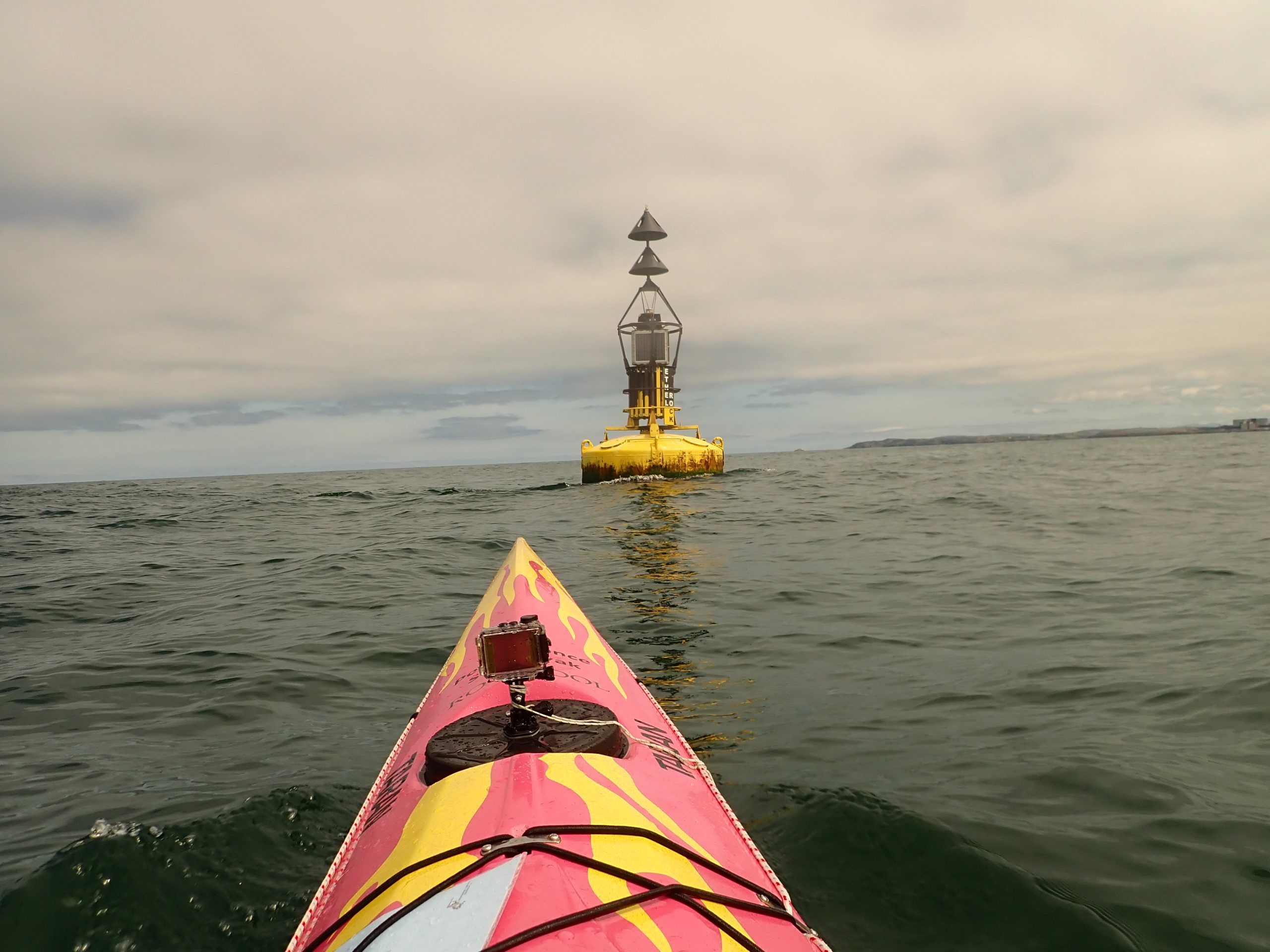
Before long I can make out the distant buoy, and there is a conveniently placed Snowdonia hill (Moel Eilio?) in the far distant, perched above the buoy as a perfect transit. Keep the peak on top of the buoy and all is good. Keep the angle, modulate the power now and then now and track nicely for #4 – straight-in behind once again. Spot on.
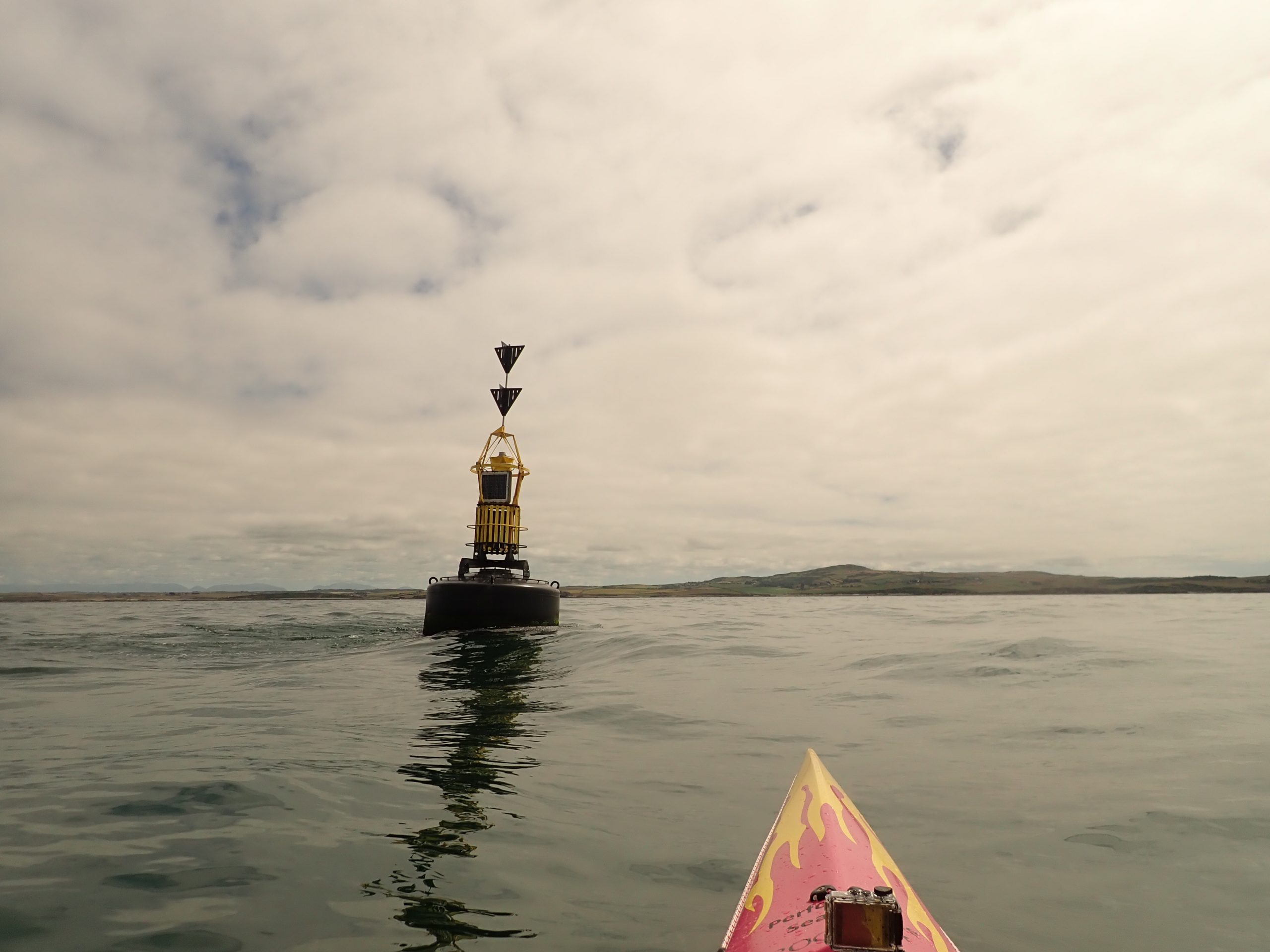
Turning for Victoria Bank it is just a simple reprise of the start of the paddle, though we extend to the Furlong buoy for the hell-of-it too. And eventually we glide peacefully into Cemlyn Bay, and nice day out with a bit of useful paddling too.
What for?
So why all that faffing-around without compass or GPS? Why the seat-of-the-pants stuff? It’s a useful skill in so many areas, but especially at the end of a crossing. Get to the end of a crossing in UK waters and that’s where you usually earn your money. That’s where the fastest flow is going to be. That’s where you have to ‘make the move’ to get to the beach/around the headland/avoid the tiderace etc and you don’t usually have the luxury of a compass bearing or a GPS track to help at that point. You are where you are and you can see where you need to be – it’s now down to you and the boat to get there.
Just what you can see, what you can feel, and what you’ve practiced.
* In the Anglesey part of the world, this is one that can also be usefully practiced out of Moelfre too, paddling to the ‘big boats’ in the Lynas Anchorage. They are usually further out, but the target is larger and their anchored-heading gives an idea of the flow.